
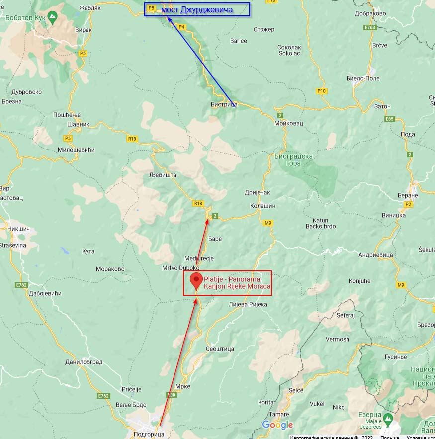
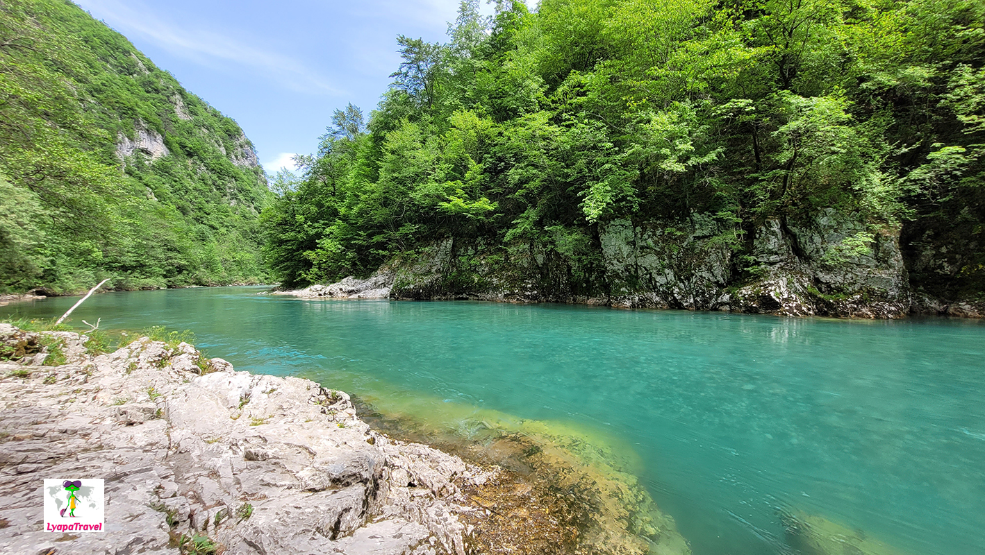
Moraca Canyon - spectacular beginning of northern Montenegro
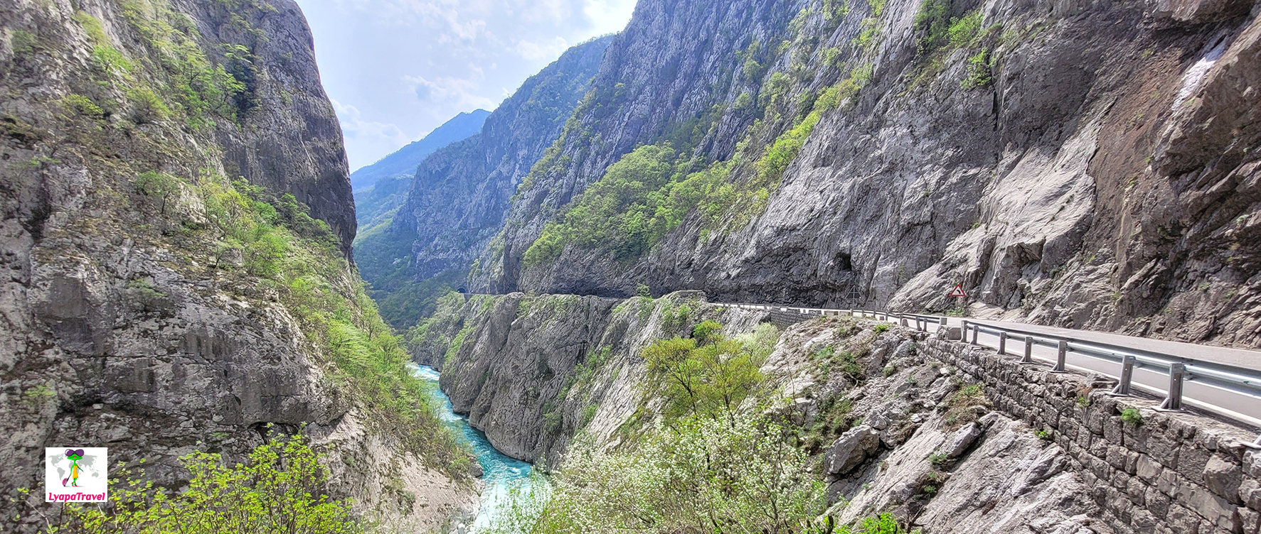
Moraca River starts from Podgorica. But the most picturesque part of the Moraca River canyon is the panorama point "Platije - Panorama Kanjon Rijeke Moraca". From this observation point about five kilometers goes the most picturesque road (the section is marked with a vertical rectangle). Canyon Moraca itself looks only passing on the way to Biograd Lake, to Tara Canyon, in other words on the way to the north of Montenegro.
Red arrows indicate Moraca Canyon and highlight the most beautiful location, blue arrows indicate Tara Canyon and highlight the most spectacular place. However, the essence of the canyon is to drive through them exactly! The canyons of the Tara and Moracha rivers are not specific locations, but the way through them itself!!!
Tara Canyon - the pearl of northern Montenegro
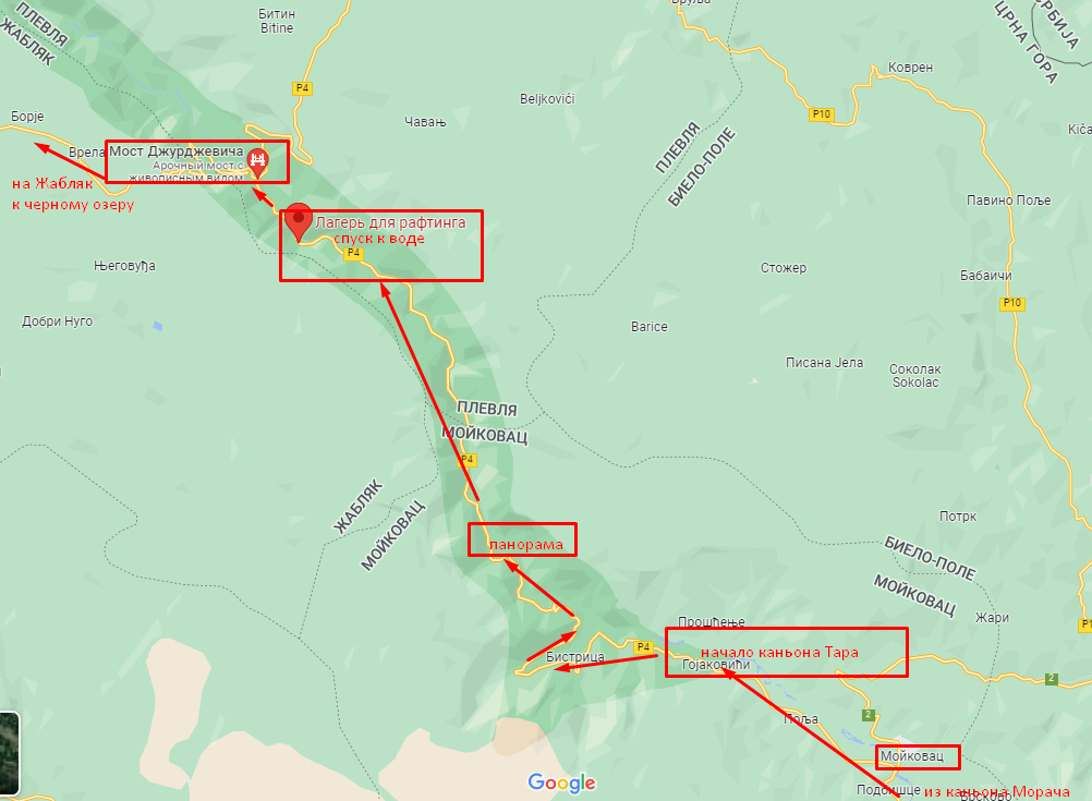
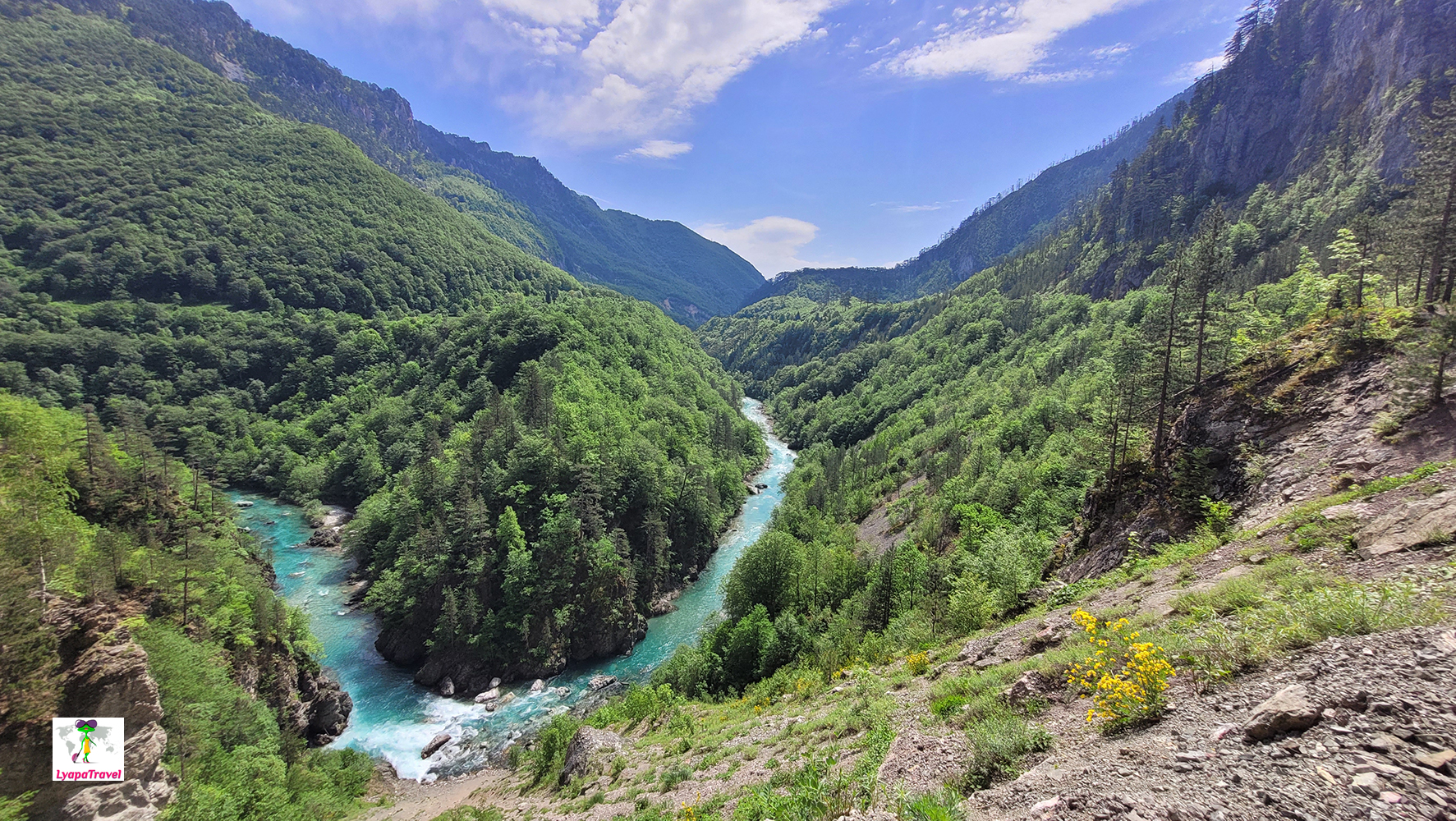
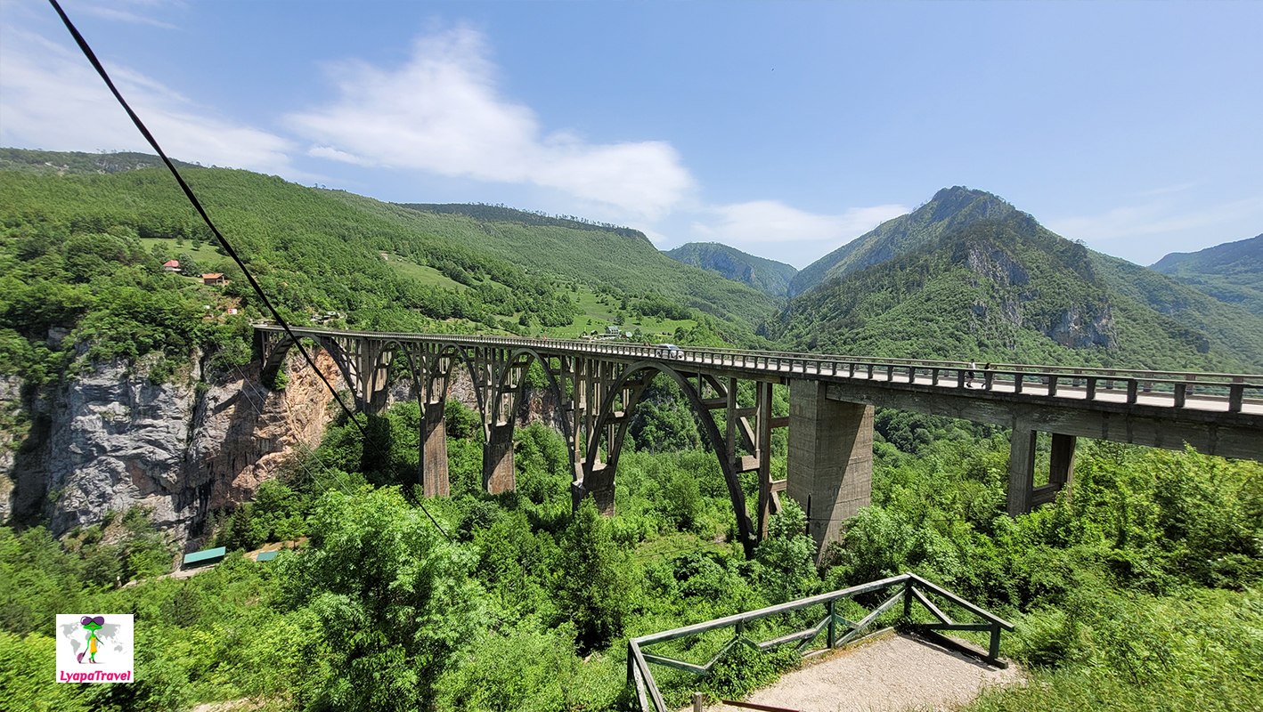
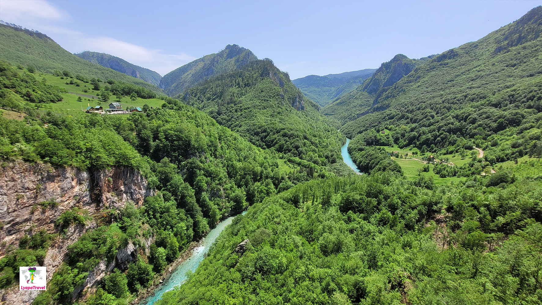
If we turn left after Moraca Canyon (after Mojkovac), we come straight to the beginning of Tara Canyon. The most beautiful panoramas on the Tara River open here. There are points on the map near Zabljak, but you can hardly see the river there. The map below shows the panorama points. The first panoramic point is right on the road (coordinates 43 ° 0' 50.11" N, 19 ° 24' 27.92" E) and you will notice it - the views are off the scale! In general, throughout the canyon there are few views of the river itself, everything is hidden behind the dense greenery. But the area is not less beautiful) It is magically beautiful here) The next point is a rafting camp (on Google maps). It is also you simply will not pass) Here the road comes to the water! And sitting on the shore listening to the noise of rapids, birdsong, you can eat or just enjoy the icy breeze, which blows around even the heat! The chill comes from the icy water... It's very atmospheric. And of course, the Djurdjevic bridge - the beauty is indescribable! No, not the bridge, although it's beautiful too) The views!!! There are also rafting and zip line centers. It's important to go all the way across the bridge. The views are from the opposite side of the bridge from the parking lot (if you're coming from Mojkovac) to the turns of the Tara. All in all, driving through Tara Canyon is 1 hour, but sitting on the bank of the icy Tara River and walking across the bridge is another plus 1 hour for sure!
Tara Canyon is the deepest in Europe - the Djurdjevic bridge is the best viewing platform
Add new comment