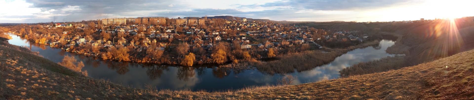
Krivoy Rog is a real attraction in the Dnepropetrovsk region. Krivoy Rog is the city of quarries and waterfalls.
Krivoy Rog is truly an unusual city in Ukraine. Let it be dirty and industrial, but unusual and interesting)! There are mountains (natural rocks - rocks and man-made industrial granite mounds), caves (mines), quarries and waterfalls ...
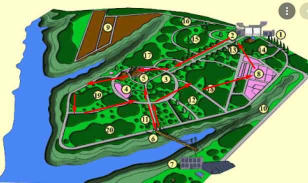
What to see in Krivoy Rog? The main sights for walking:
- Tokovsky waterfall is located between Krivoy Rog and Nikopol in the village Tokovskoe. It is not recommended to go here until all the roads are made. The nature is good enough, but we do not recommend to go specially ⭐⭐⭐
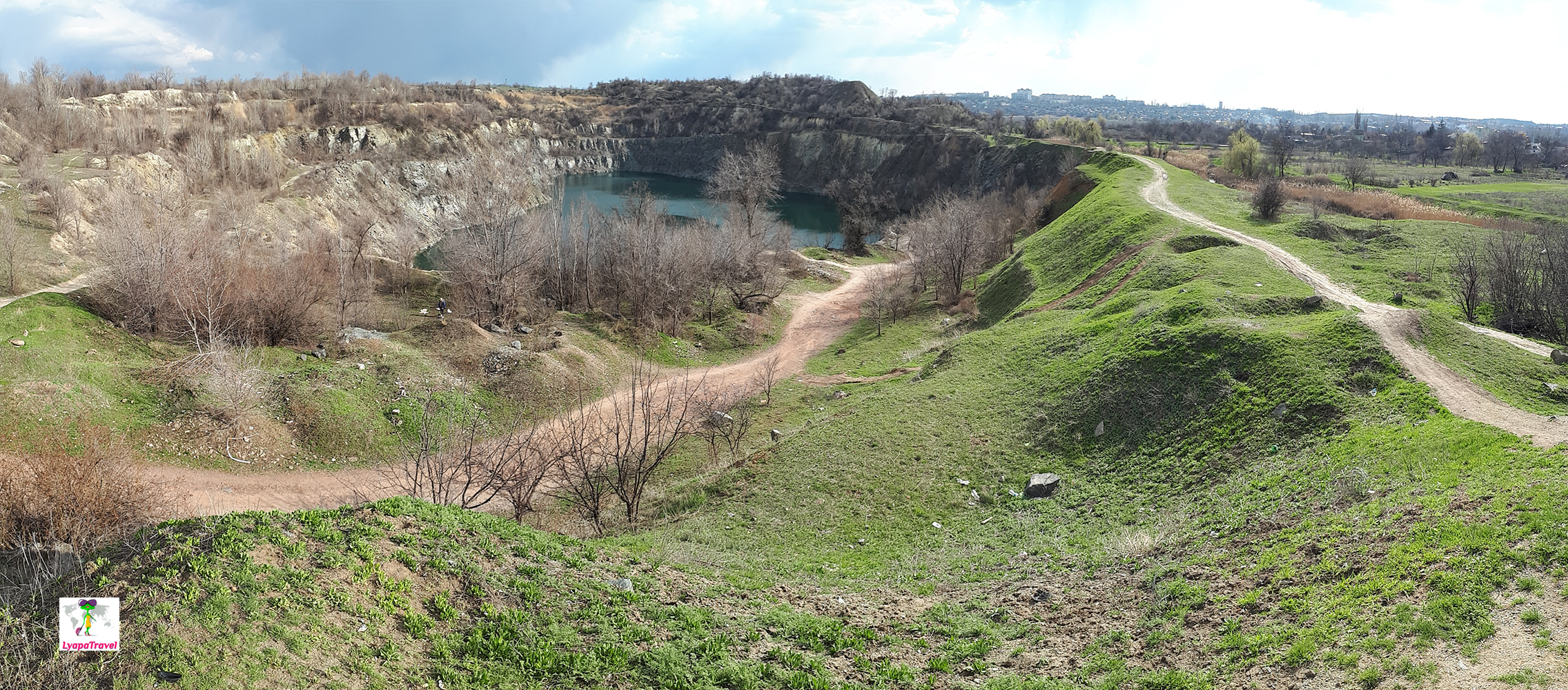
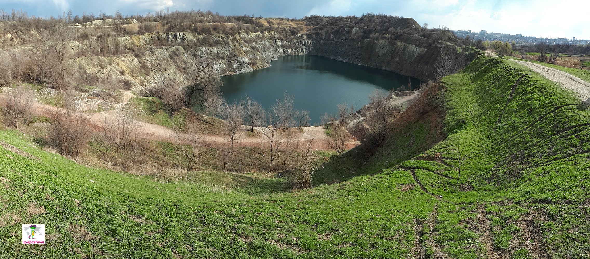
- Tokovskiy quarry flooded - nothing to see, especially when there is no greenery yet ⭐
- YUGOK quarry (observation platform) - you need a permit to visit it. It is possible to enter only with a tour or with a permit from the quarry management. The scale is spectacular. It is possible to visit, but time is wasted because of permission, and there is essentially nothing to see. ⭐⭐⭐⭐
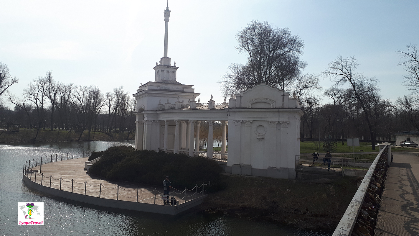
- The Botanical Gardens are the jewel of the city. Time to visit from 1.5 hours and much more ⭐⭐⭐⭐⭐
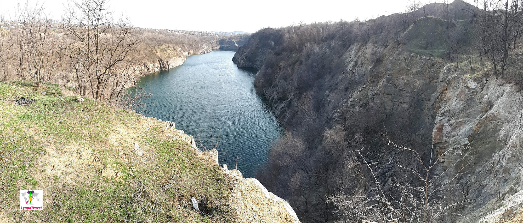
- The flooded quarry of NKGOK (Krivoy Rog Lake Baikal) - there is an active production site nearby and this place is not suitable for recreation. We will not recommend to go here only because of the photo.
- Karachunovski quarry - when everything is green, it is a good place for walks, and the waterfall White Rocks is very close. There's nothing to do here in winter. ⭐⭐⭐⭐
- The rocks of MOPR are all rocks that protrude above the ground, there are about 12 of them. The best view can be seen from the Mountain of Grace and Little Eagle - observation deck on the Krivoy Rog! ⭐⭐⭐⭐⭐
- Eagle's Nest Rock - from below is the best view of these very protruding rocks of MOPR. There is a view from above, but the view is much smaller compared to Mount Grace. ⭐⭐⭐
- Oktyabrsky Granite Quarry - a place to walk and barbecue! ⭐⭐⭐⭐⭐
- White Rocks waterfall ⭐⭐⭐⭐
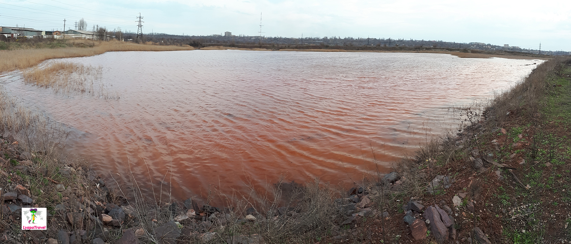
- Red technogenic lake (Artem-1 mine) - dust and dirt from ore mining. Garbage dumps and working area. There is nothing to do here ⭐
- Chinese colored mountains in Krivoy Rog and Martian landscapes - beautiful in pictures, but reality unfortunately, is not impressive ⭐ The Park named after V.P. Krivoy Rog is located in the center of the city.
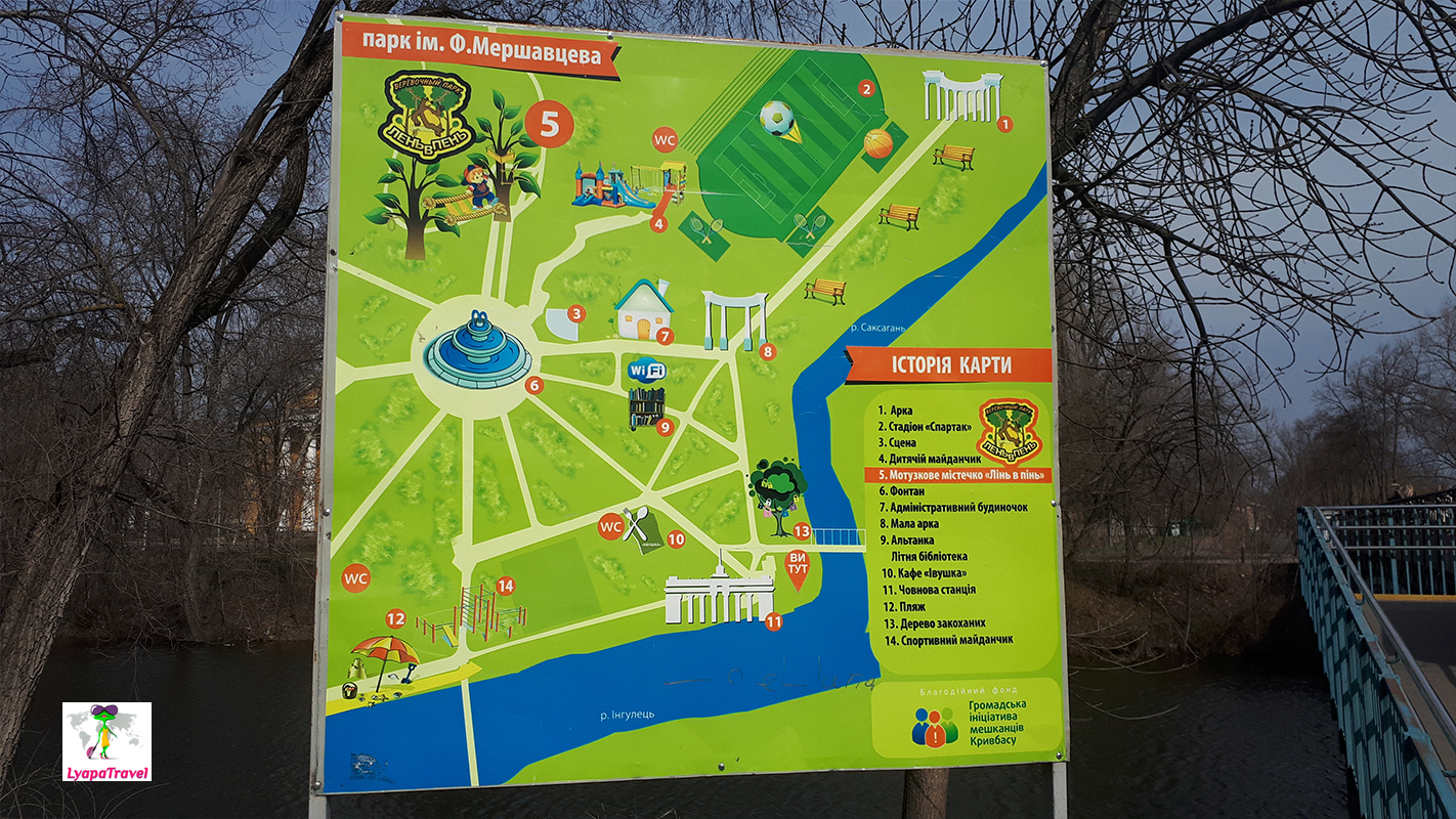
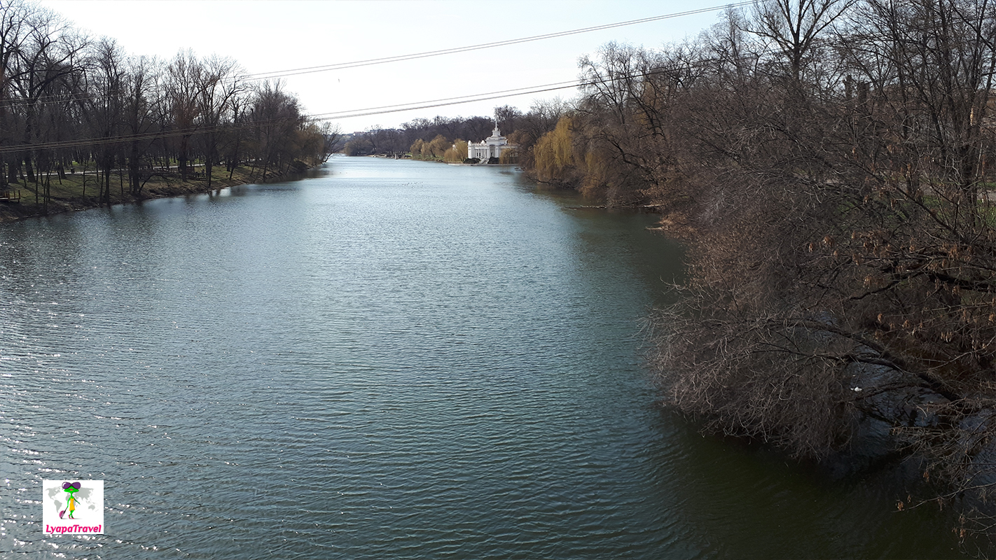
- The park named after F. Mershatsev (in Russian "Mershatsev's Park"). The Mershavtsev Park (old name: Gazeta Pravda) is a good place to walk along the river and under the green crowns of the park in the warm season. There's not much to do in the winter. ⭐⭐⭐⭐
In Krivoy Rog, widely known are the red waterfall (Tokovsky, Sholokhovsky) and White Rocks (rapids Ingulets River). Quarries in general a large number, there are active and flooded. Tourists are attracted by both of them. Particularly popular are the active granite Southern Mining and Metallurgical Plant and the flooded ones: NKGOK, Karachunovsky, Oktyabrsky granite, etc.
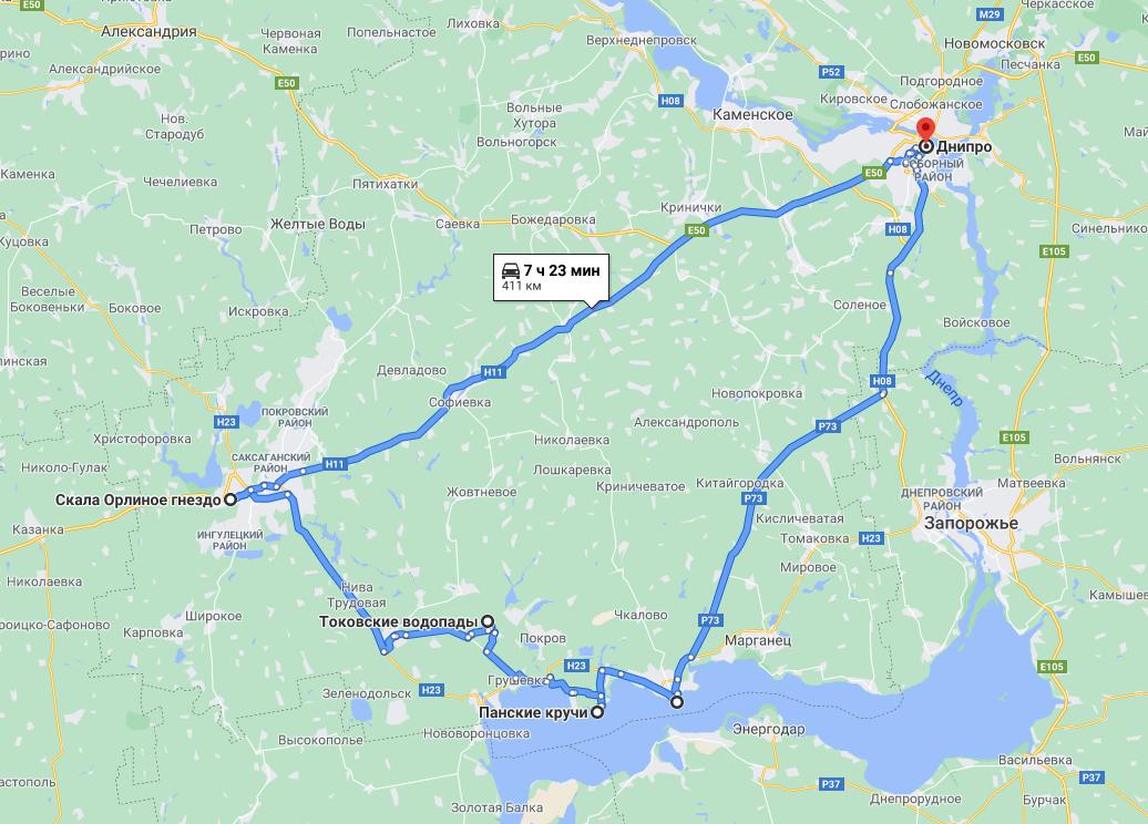
To visit the local attractions can be in various order, below we will outline our routes, with their pros and cons)
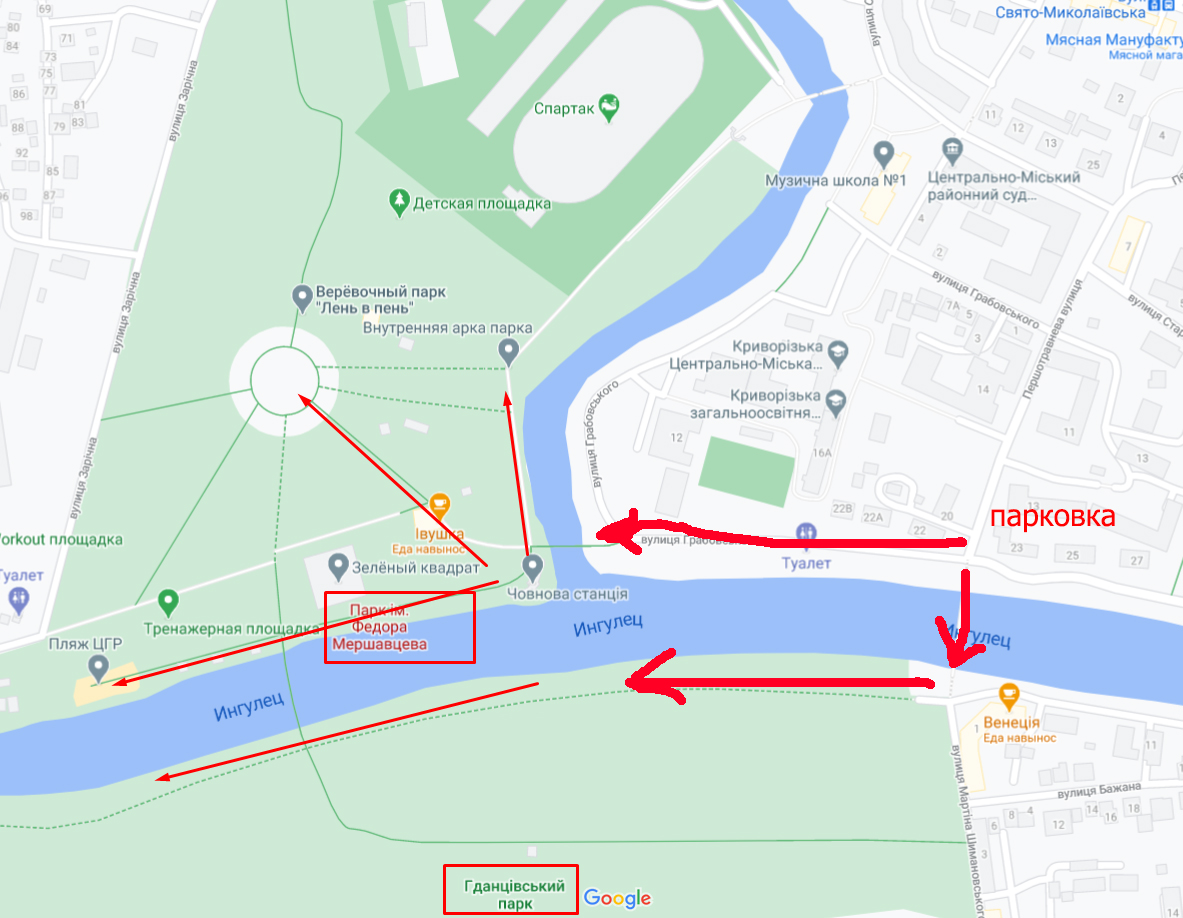
One Sunday we did a ring route № 1: Dnepr - Nikopol - Tokovskoye - Krivoy Rog - Dnepr. Highways require far less attention to themselves. At the end of March 2021 the route Krivoy Rog - Dnepr is perfect. The highway Dnipro - Nikopol on 4-, potholes and patching appear after the exit of the highway to Zaporozhye. Roads Nikopol - Tokovskoe - Krivoy Rog are holes!!! It is difficult to evaluate them in points ... The most "bright" feelings were caused by the roads approaching Tokovskoe. Frankly, combining the views we saw and the lack of roads - a visit to Tokovsky waterfall is not recommend to anyone! The other day we came to Krivoy Rog by the highway from Dnieper and drove around the city - the route № 2: quarry NKGOK, Mershavtsev park, Eagle's Nest rock, Karachunovsky quarry, Chasha lake (we never saw it, and we spent about 1.5 hours on it!), red technogenic lake of mine Artem-1. Route number 3: visit to the quarry of Yugokhodka with the excursion, which is organized by the city authorities - the flooded granite quarry Oktyabrsky, aka Zarechny quarry.
Our main goal for the first time was the Sholokhovsky cascade waterfall in the village of Tokovskoye. We went through Nikopol to see Nikopol itself and especially Pansky steeps in Kapulovka village. Then we wanted to see a lot of things in Krivoy Rog. On the first day, we couldn't get much, so we had to go back again. But about this below)
Pan's steeps - a gorgeous natural landmark near Nikopol
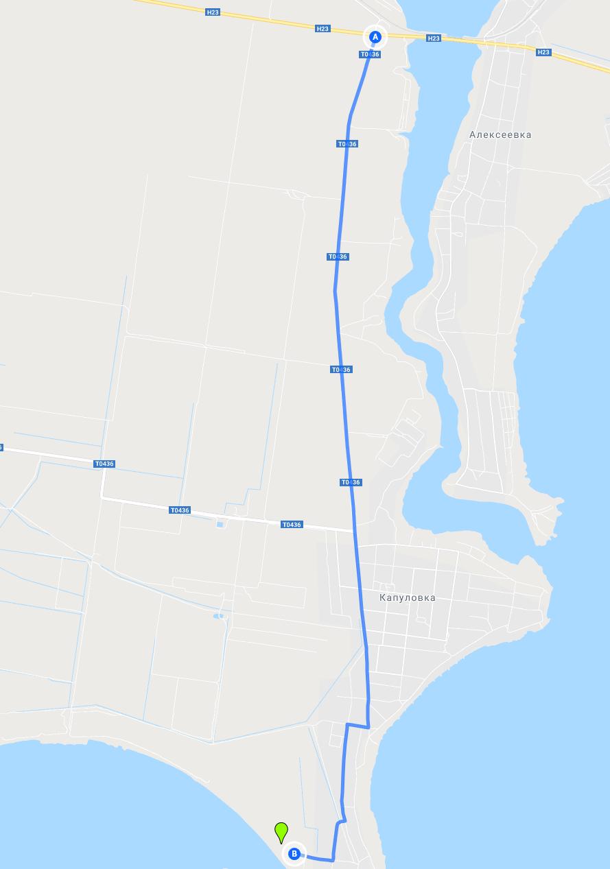
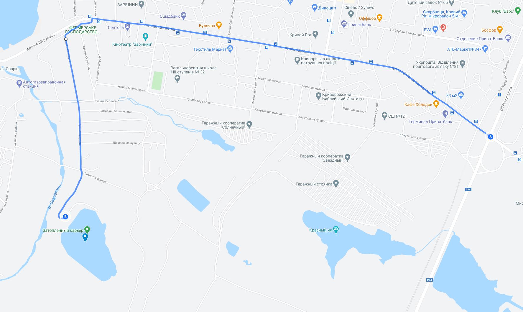
Between Kapulovka and Pokrovskoe villages, there is this landmark. Judging by the small number of reviews from the Internet, about it have not yet become known! Approach it even still on a perfectly normal road) The map below shows the turn that leads to the observation deck. Don't get lost, you have to turn right (it's at the end, at point B itself) and drive through the cemetery. So-so route...but the views ahead will overshadow everything!
Point A - the exit to the left of the highway Nikopol - Krivoy Rog. Point B - the best view "Panski steeps.
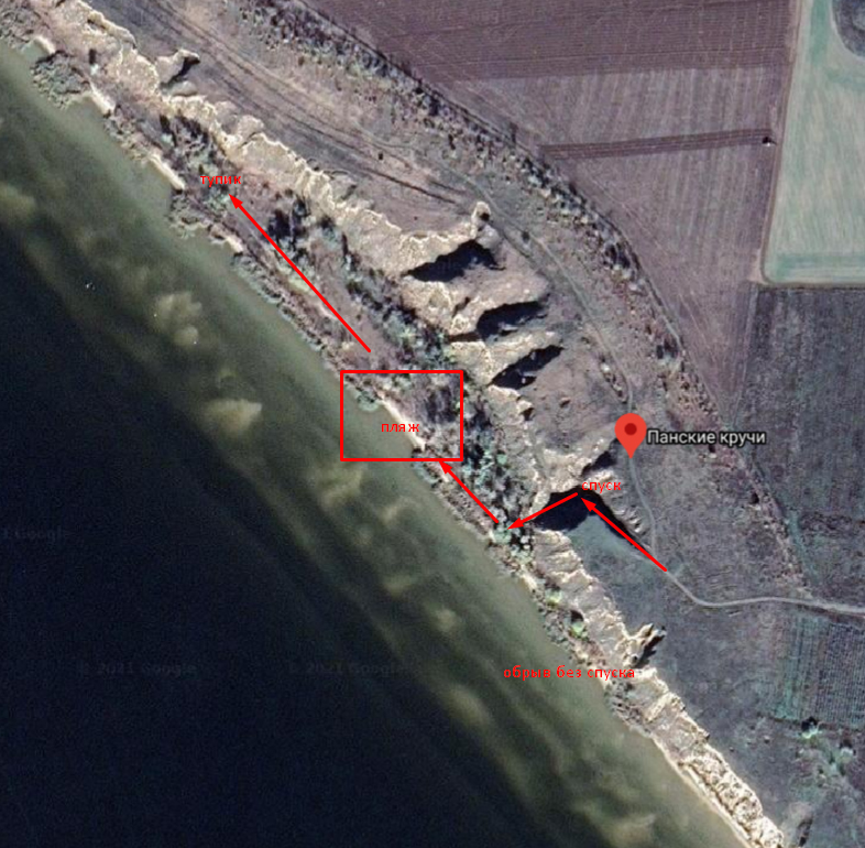
Pan cliffs and a chic beach!!! In views it is analog of Cape Tarkhankut (Atlesh) in the Crimea. On top you can easily drive a car. But the best view is from the side, as indicated on the map. Down also lead two tracks ... But to go down you can either a jeep or a VAZ) Well, and certainly on quad bikes is where to ride. You can walk around on the bottom too and enjoy beach and shashlyk rest! We had a lot of spots for viewing ... We really did not expect such a beauty of Pansky steeps and did not put in time for a picnic on the shore. But so wanted! The atmosphere of the place was very special, it looked like a place of power! Near the shore and shallow and smooth entry into the water on the cleanest sand!
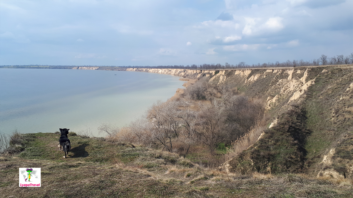
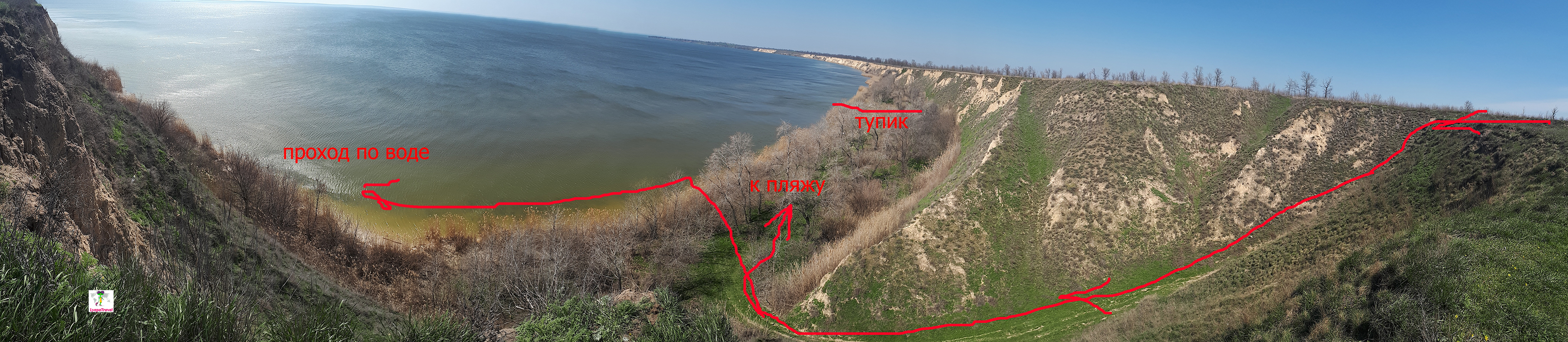
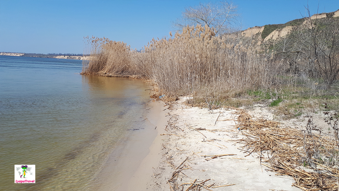
After the descent, to the right there is a path to the "beach", further the path already becomes and passes into the hashi. In fact, there is very little room for recreation. But this beach is really beautiful) After the descent, turn left is not possible. You only need to go out on the water and across the water to the "beaches", which are on the left. Along the coast of the shallows and walk here is better on the water, i.e. when it's warm. We were in April, there is not much to walk)
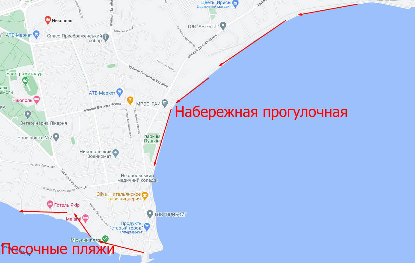
Nikopol - a city with the potential to become a Ukrainian resort
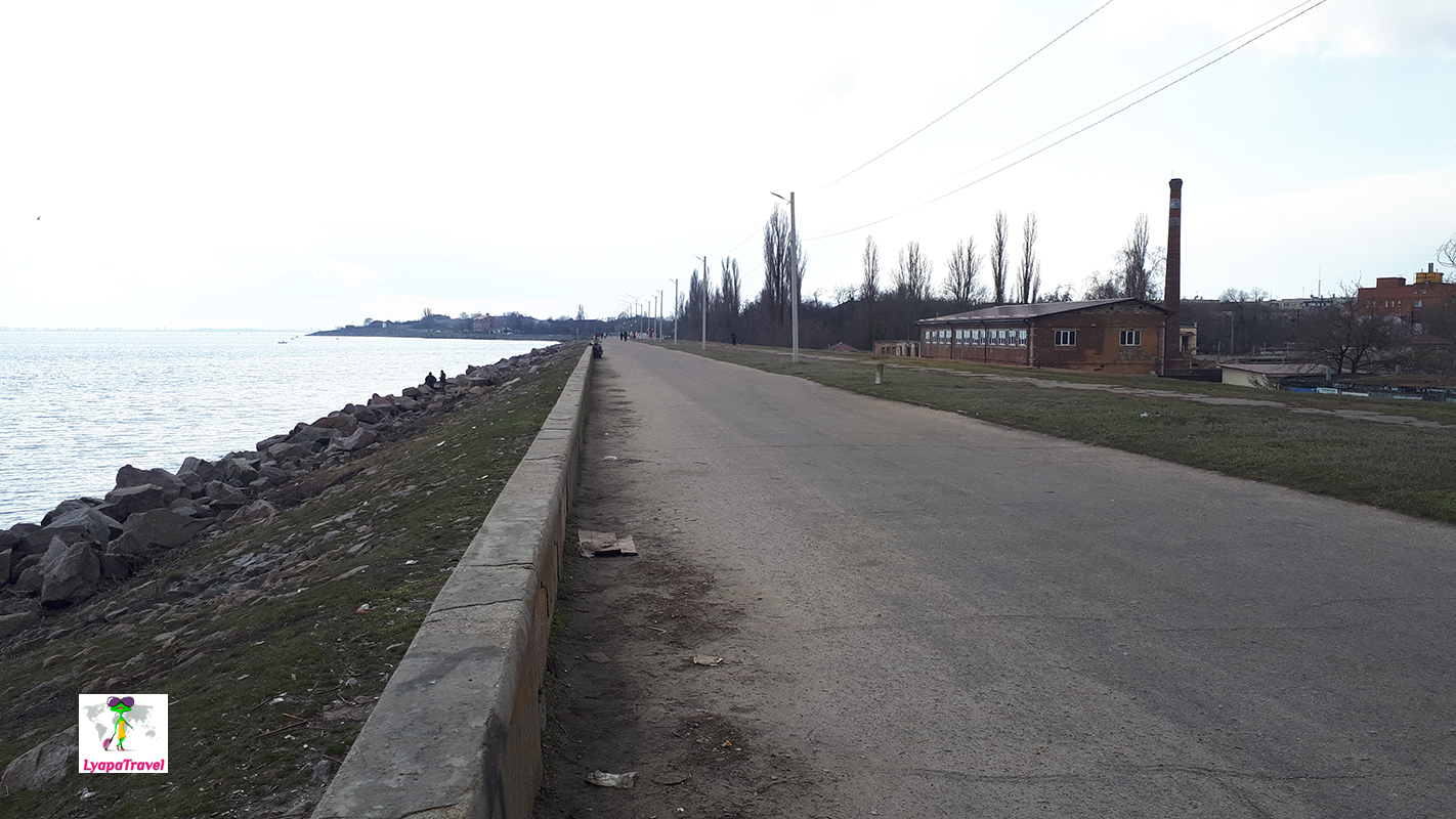
The city has a wide embankment, but at 2021 it is in a deplorably dismal condition. The embankment is walkable, but cars can drive along it. To avoid walking, you can take the arrows to the end of the embankment, there you can turn onto the embankment itself and admire the views. Then you go along the road along the water, behind the turn there's a surprise).
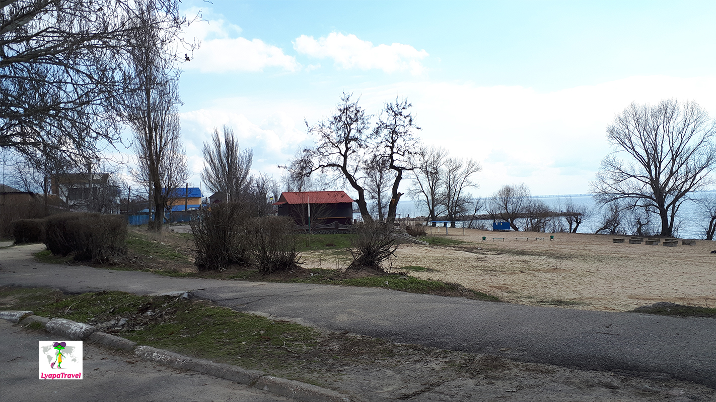
Behind the quay in the direction of Kapulovka there is a whole series of sandy beaches. It feels like you're in Berdyansk or Kirillovka)).
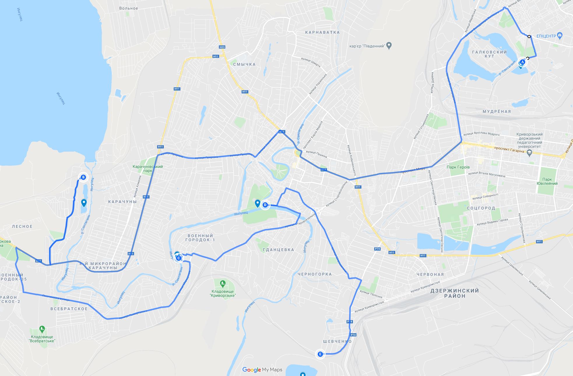
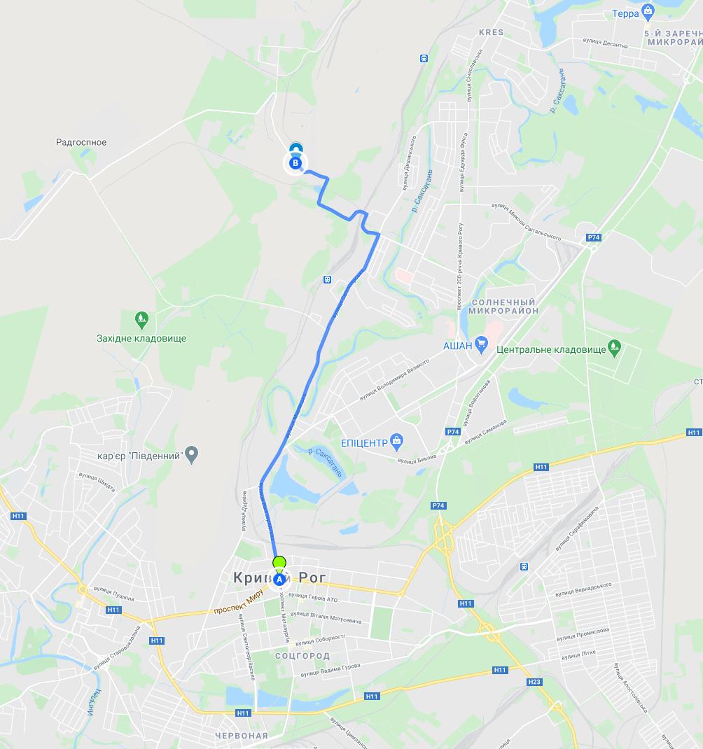
Route #2: The sights of Krivoy Rog
- A - man-made lake
- B - Karachunov quarry
- C - Eagle's Nest rock
- D - Mershavtsev park
- E - flooded quarry of NKGOK
How to get to Tokov Waterfall?
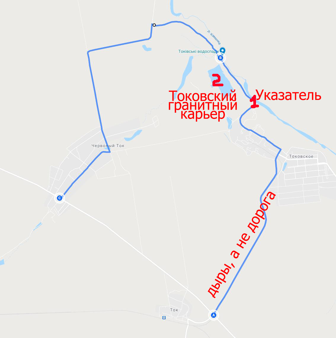
Important: Do not try to drive here in rainy weather. Near the waterfall the roads are unpaved, the passage will not be possible. Also, the asphalt roadbed, being in deep holes, can bring much more discomfort than in dry weather ... In flooded potholes you can not see the depth, and they are deep in some places( From point A to the village Tokovskoye - driving speed is not more than 20 km / h and to bypass, not even on the fields ... From the waterfall to point C, the road is conditionally better, because you can go even 60-80 km / h, but here's a route to Krivoy Rog from point C leaves much to be desired. The route is shown on the map below.
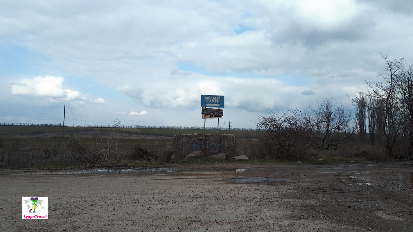
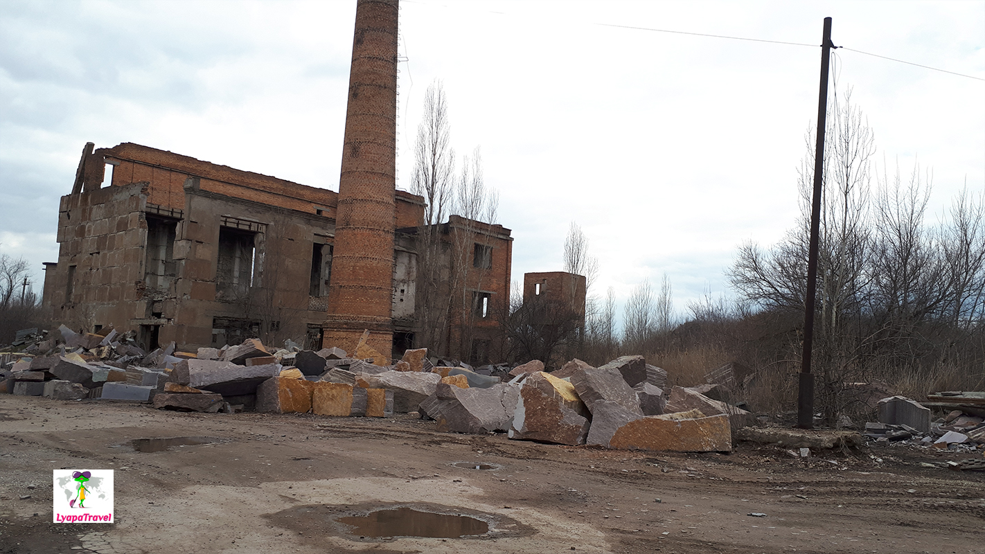
Landmark, originally, the village Tokovskoye, then the sign to the waterfall (point 1). After the signpost one road, keep right, there are forks to the local work areas (nothing to do there). On the way to the waterfall there will be the working Kiev granite pit (as from a song: ...garbage and dirt roads ...) and Tokovsky flooded pit (point 2) just before the Sholokhovsky waterfall itself. On the way to the waterfall you have to wonder if you are going there ... everything is so dismal and not beautiful! And when you come to the place itself you are in a huge disappointment...
There is nothing to see((( We were there in the spring when the snow came off, and what is there in the summer in the drought? Trickles? You shouldn't go here specially! It is not an attraction on a Ukrainian scale).
Time to visit the waterfall itself and the flooded Tokovsky quarry - no more than 40 minutes for photos, but the road will take 2 hours for sure(((.
Then we went straight to Krivoy Rog, to finally start to explore the local attractions of Dnipropetrovsk region. The time was not calculated and on this day we had time to look only a little bit. But if you go only to Krivoy Rog, and to prepare the preliminary features of the route, you can do all in one day. In more detail we were able to understand when we came here the second time).
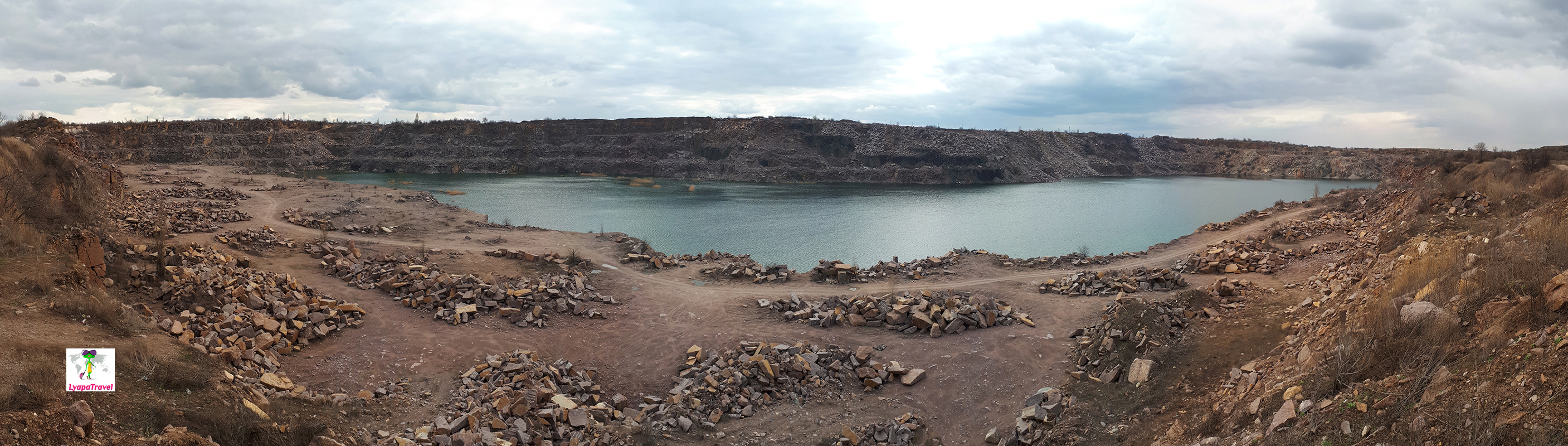
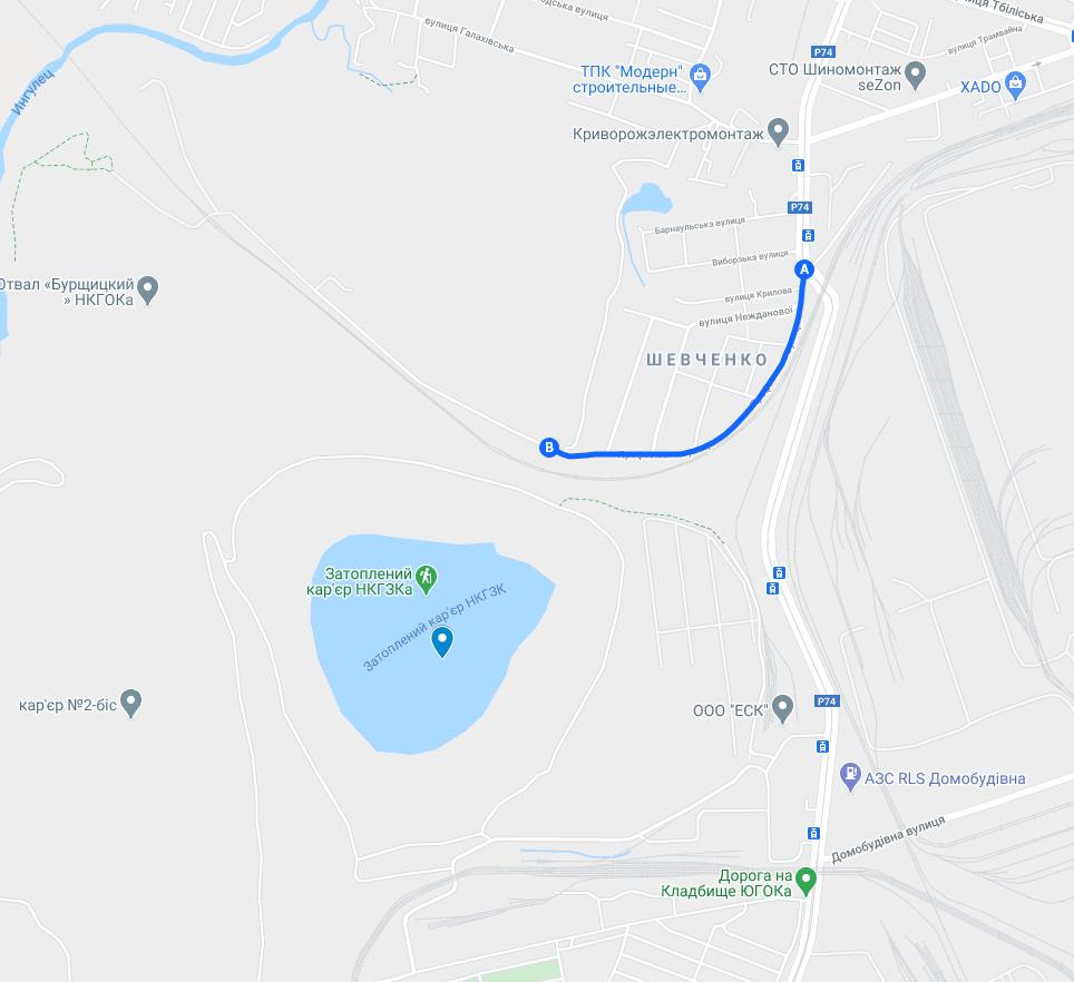
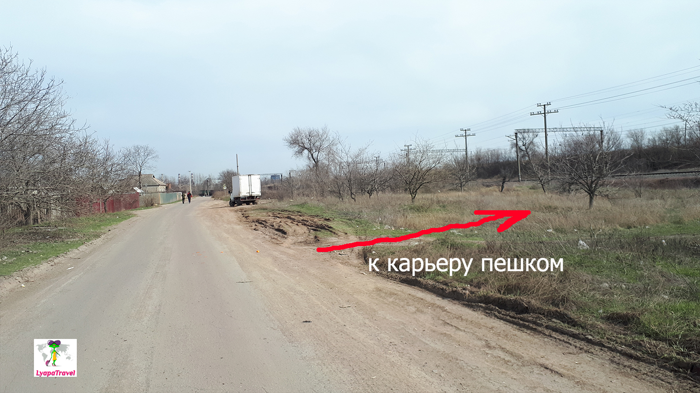
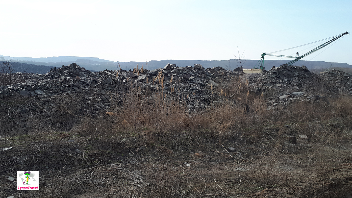
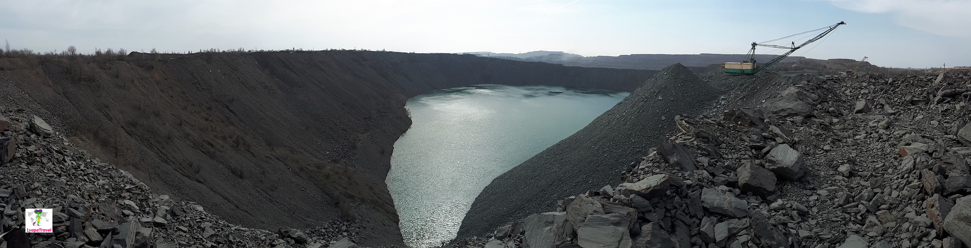
The flooded quarry of NKGOK - Krivoy Rog "Lake Baikal
Getting here is not so easy. First, you can't drive up close, and second, the navigator builds a route on the road, which is closed. You have to go by the road indicated on the map below. Before the bridge over the railway tracks, we turn right. Drive along the edge of the rural area. The landmark is the end of the private sector. On the right is a private sector. On the left is the "direction road" to the quarry. Do not be afraid of heaps of granite and working machinery) Cross the railway track. It is necessary to go in the direction of water, so you will come out to the miracle lake) At the end of the private sector is still a good road. We used it on our way back. First, we drove forward, closer to the dump and made our way through a pile of piled granite mountains...it was really something))) Climbing over the rocks, with real BelAZes passing by - picturesque)
Actually it sounds more beautiful than it is in reality. It's impressive on a grand scale - yes, but that's all... Around flying dust and debris from the local landfill. I want to take a picture and run away from there as soon as possible. This is not a place to rest! Time to visit 20 minutes with walking and photos)
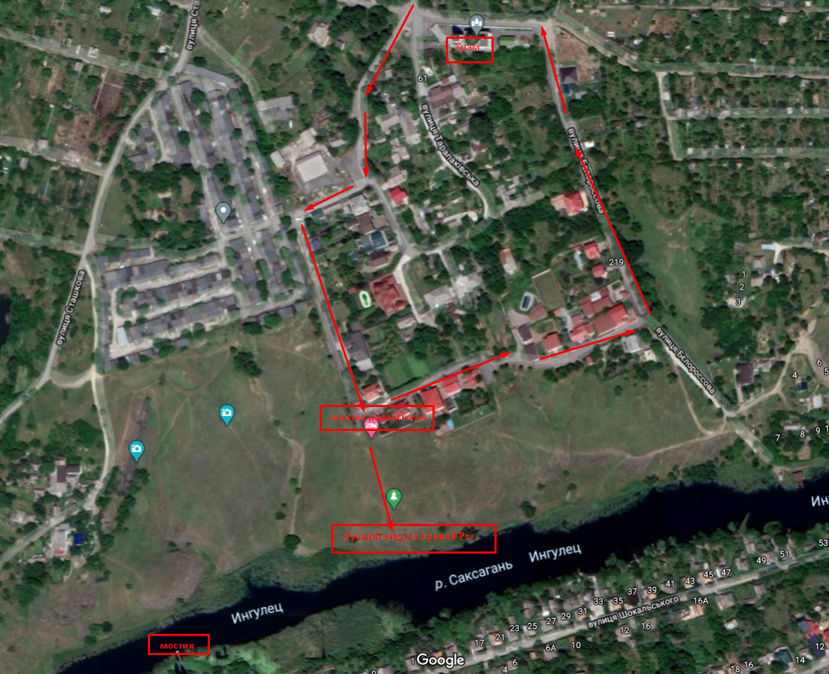
The rocks of MOPR - the best view of Krivoy Rog
How to get to the cliffs MOPR?
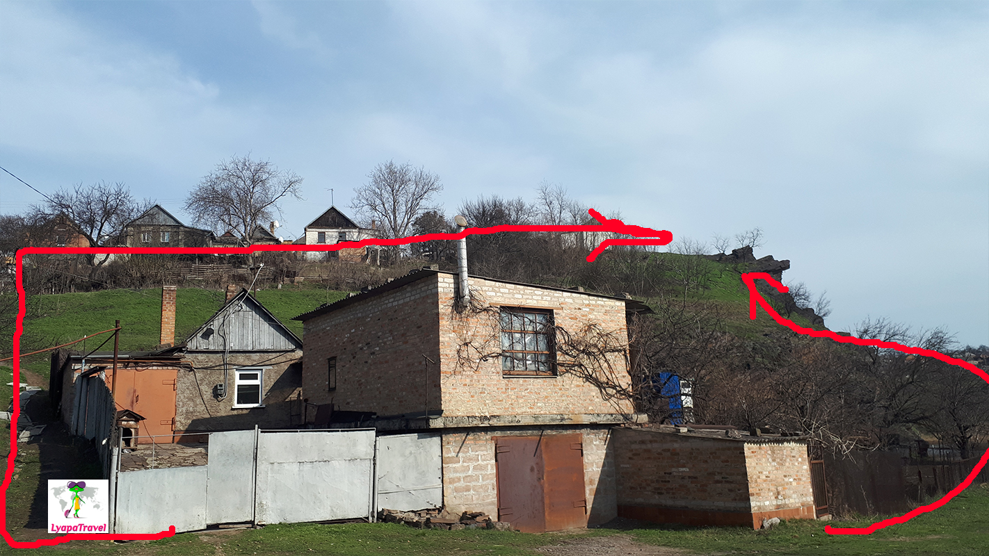
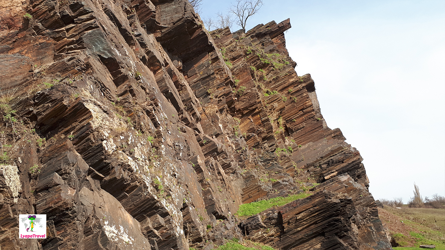
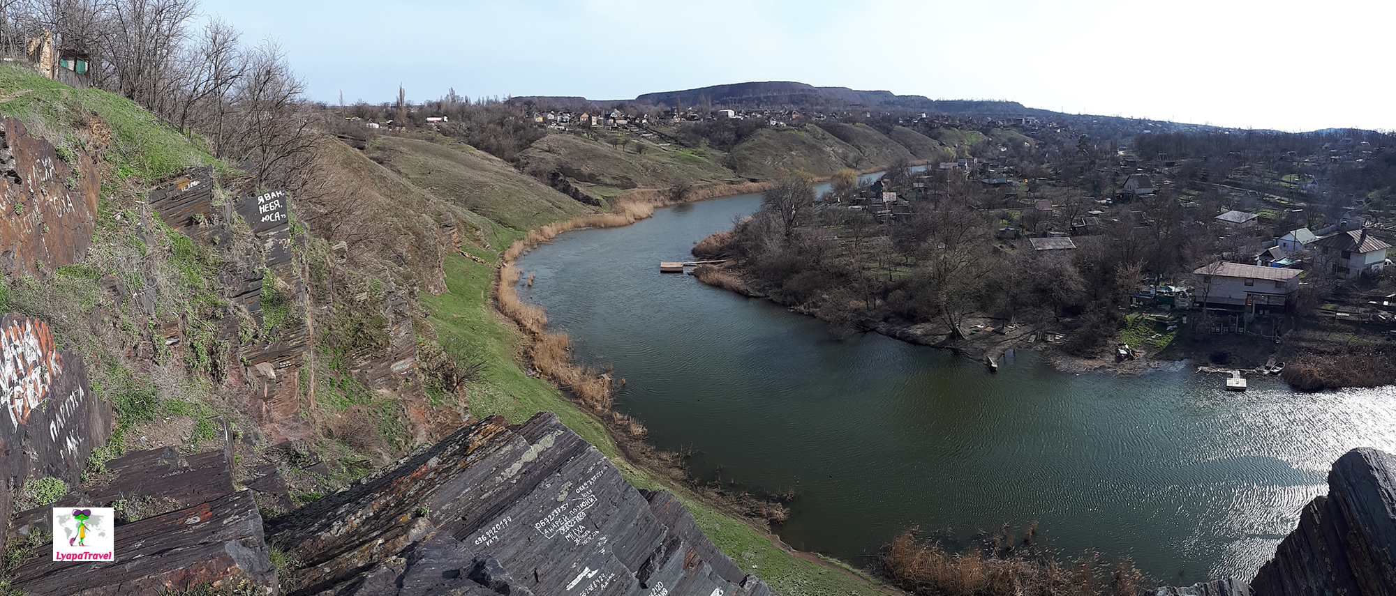
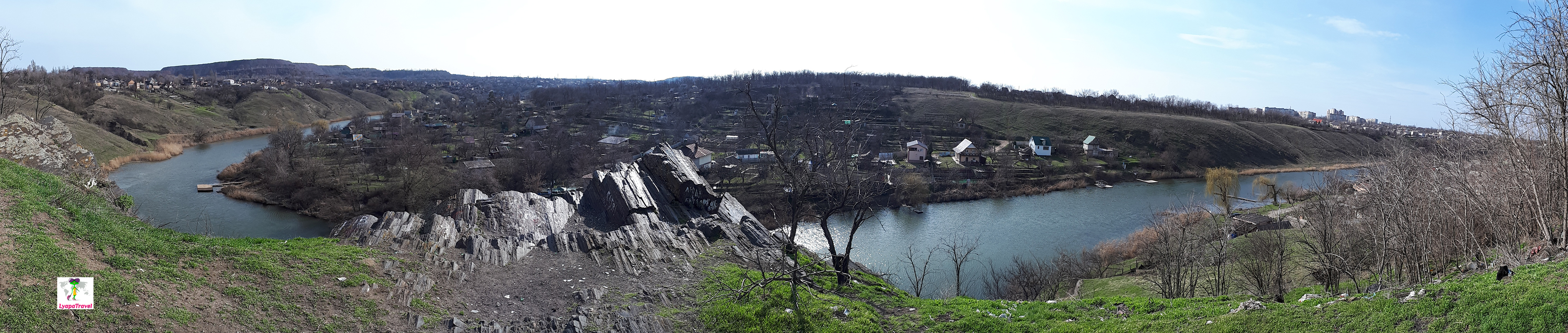
We should start by explaining what the Cliffs of MOPR? - It is a geological rock, protruding above the surface of the earth. In Krivoy Rog, according to information from the Internet, there are about 12 pieces. That is, all together they are the Rocks of MOPR. Eagle's Nest Rock is the best view of the rock from below (although there is also a view from above), and the Mountain of Grace is the best view of the Krivoy Rog!
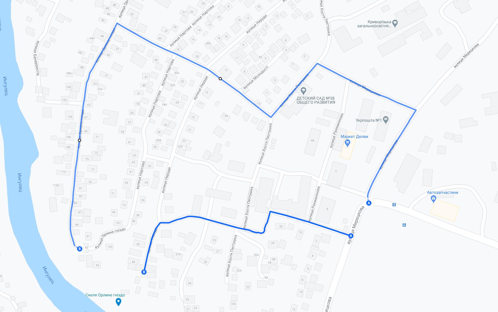
To go here is better at sunset. In advance, you can look at the rocks from below, but there is no special resonance in it. Using the pointers of the telephone navigator, if you type Eagle's Nest, then Google leads to Eagle's Nest Street - this is the opposite side from the mountain of Grace. If you drive on the navigator, to the left is Eagle's Nest Rock. There is a view of the cliffs from below and above. If you turn right from Eagle's Nest Street, you will see a bridge in the water with a view of Mount Blagodat.
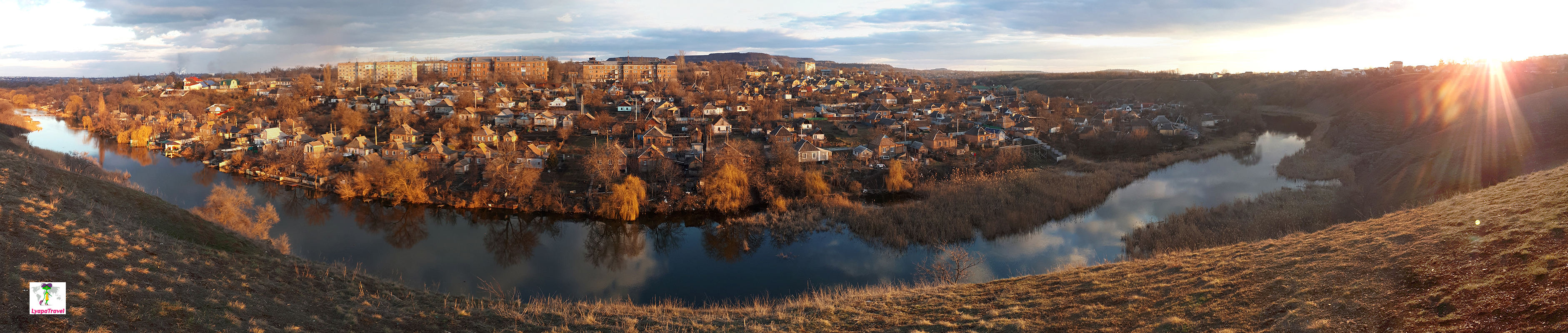
The best view of Krivoy Rog is from the rocks of MOPR around Gazeta Pravda street, Blagodat mountain and cliffs Malaya Orlinka. Do not confuse rocks MOPR in general and the Eagle's Nest (as it was with us). View everywhere opens on a looping river Ingulets very beautiful) Eagle's Nest Cliff, a little to the left of the mountain Blagodat, if you look at the map below (under Waterfall White Stones).
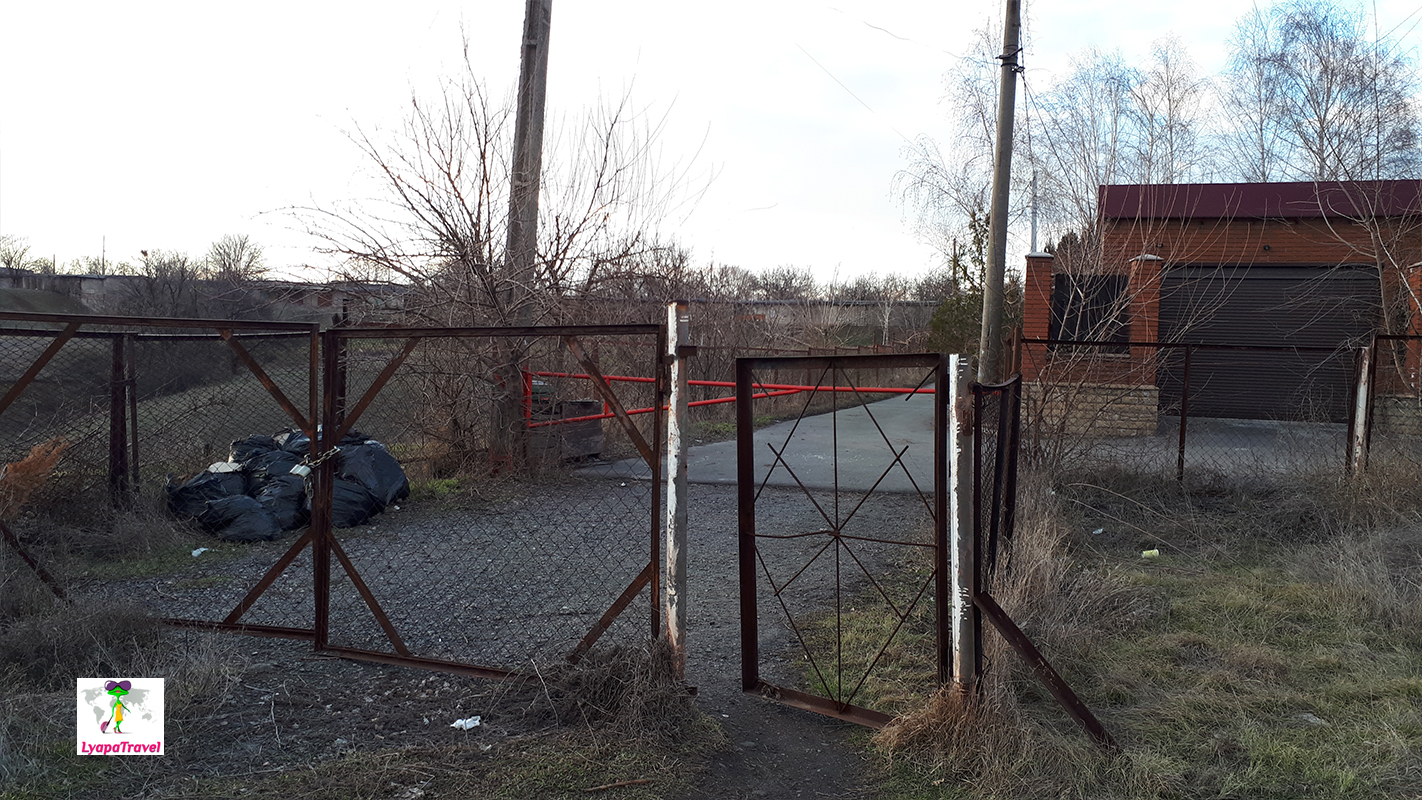
Mountain Blagodat - to park directly in the private sector, there are not many places. Grace, and wishing to admire the beauty of Krivoy Rog not a lot) from the private sector and go to a vacant lot - Cape Ingulets - to the precipice (for clarity), there through the barrier and the gate pass as in the photo below.
Eagle's Nest Rock and Mountain Blagodat are on different banks. If you take into account that you don't want to look at the rocks themselves, you can only drive up to the mountain Blagodat to meet the sunset. Time for visiting - purely for photo, up to 30 minutes. But in general here beautifully and you can come with a chair to meet the sunset) Oh very much here beautiful! It reminds me of the "city model" from my childhood, when you can look at the houses and streets from above).
Eagle's Nest Rock - viewing platform on the Krivoy Rog
You can drive up the road to the very top and the very bottom. Or you can park in one place and walk to the other along the path. You can park right near the houses in the private sector. There is not much to do here, photo and move further. It takes up to 30 minutes to explore from above and below. If you park below, there will be a trail on the right, but "goat". It is better to go around to the left, there is a path for people) But to see the rocks from below, you have to go exactly to the right.
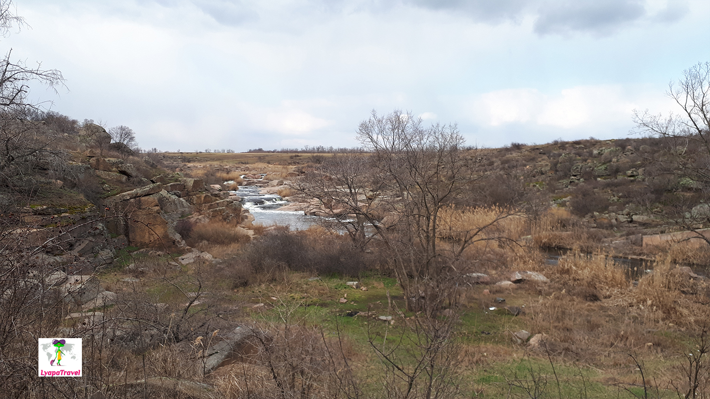
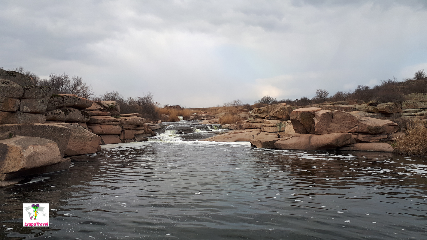
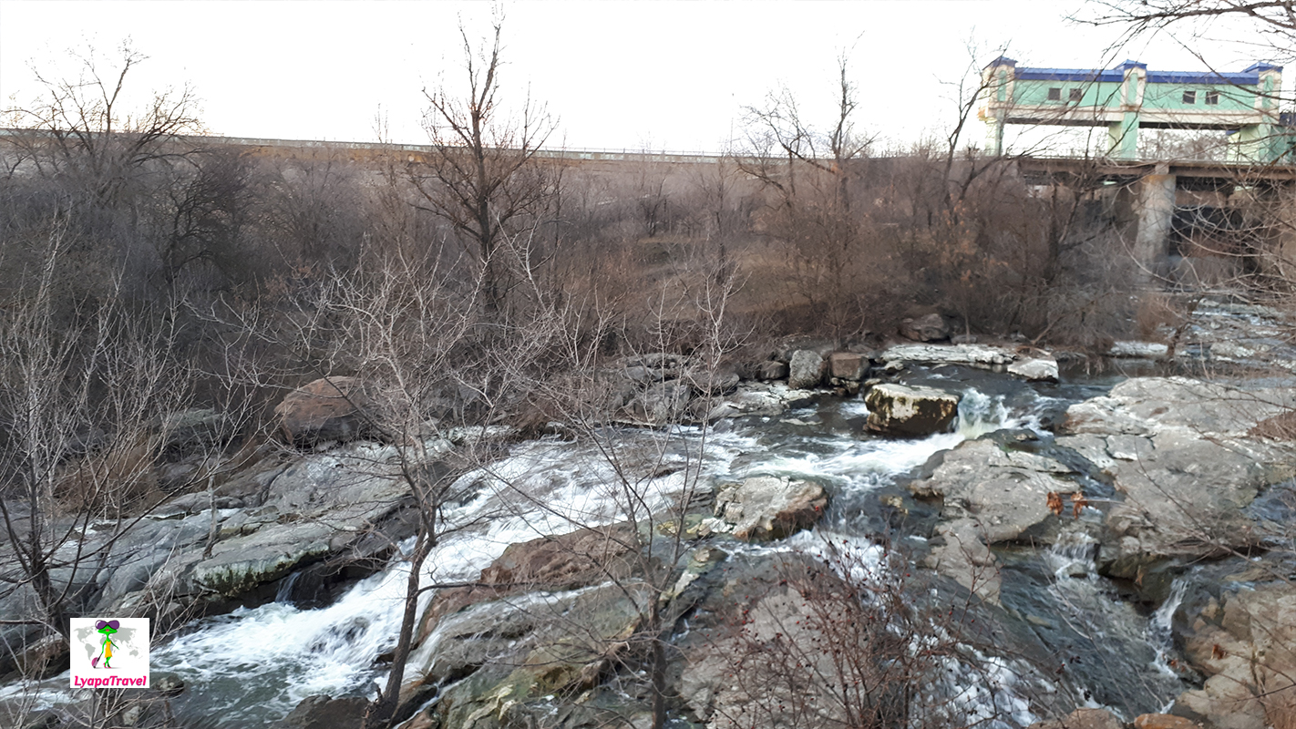
The waterfall White Stones - a sightseeing attraction of Krivoy Rog
How to get to the waterfall White Stones?
This is a reasonable question. Since the Internet mostly write - a landmark on the railway bridge. However, nothing becomes clearer... Now more in detail about our personal experience. From the rocks of MOPR you can go either to the eastern or to the western part of the waterfall White Stones.
The road to the eastern waterfall is all on an asphalt road, through the city streets. The road to the western one goes through the private sector and the road leaves a lot to be desired, especially where it becomes dirt like washboard. You also have to keep in mind that you don't know which part of the falls will be full at the time of your visit. We, for example, got in when the West Falls were raging. According to the Internet: The waterfall is full from March to May, and 50% from May to August. After that, the lock is shut off until spring. So another great tip #1 - you should visit the White Stones waterfall in the spring!
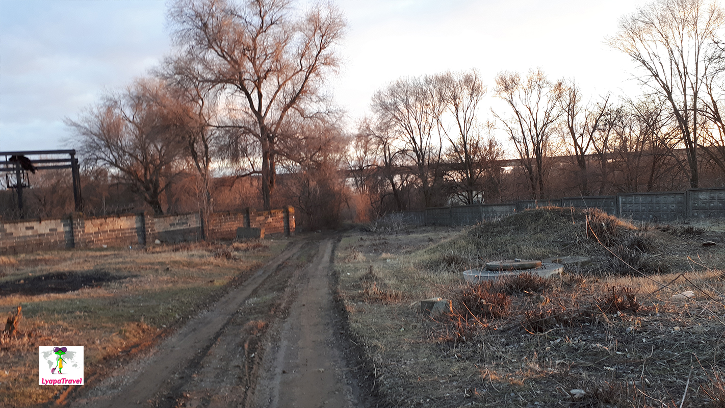
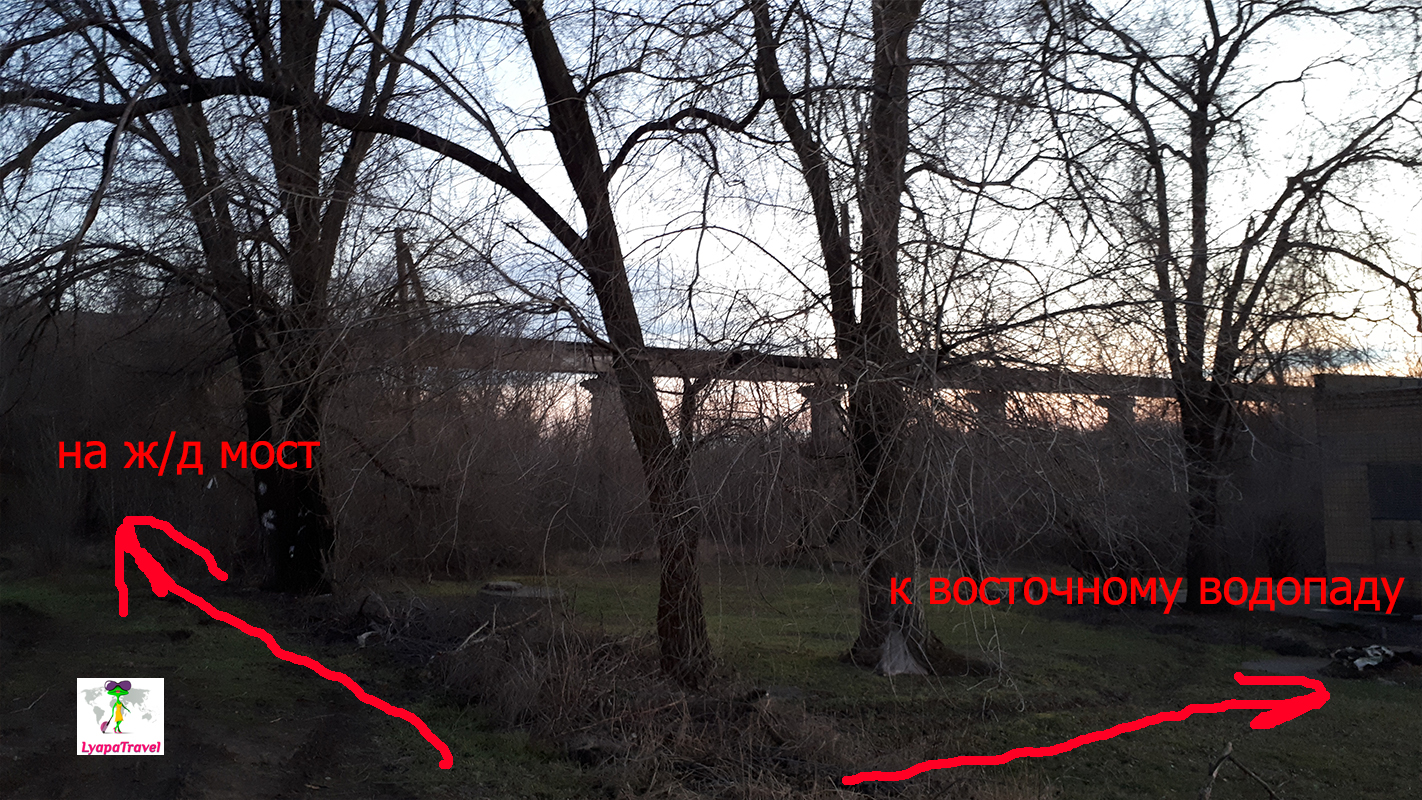
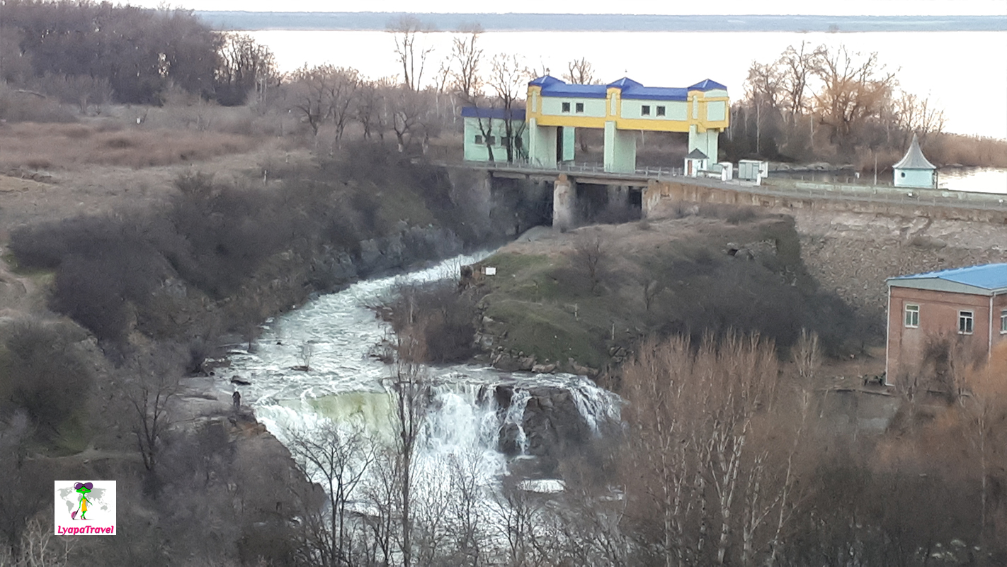
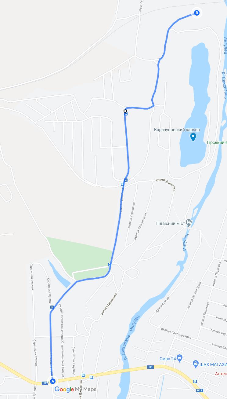
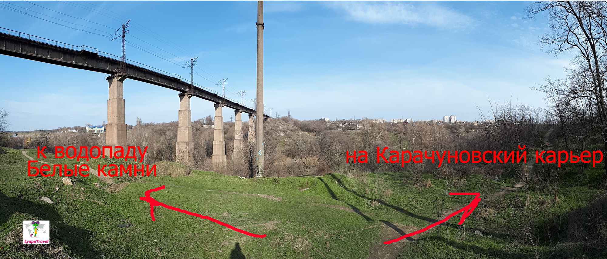
You can go by the navigator to the eastern waterfall. But at some point you will run into a fence. You will go ahead of the road, but it is closed, as it is either a dam or a dike... You have to look to the left - there will be a hole in the fence for the passage) Externally, it looks like a place for garbage... Well such is the way to the local attractions. Drive in and go left, there is another hole (photo below) and then drive up to the lodge. This is where the road ends. As you can see in the photo below - in the direction of the lodge - the path of descent to the waterfall. To the left - the path up to the railway bridge. Life hack number 2 - first it is better to go up to the railway bridge, to understand what part of the waterfall is active.
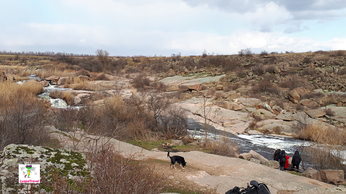
The path to the left leads directly to the railway bridge. It is quite an interesting view. On one side of the railway bridge you can see the whole waterfall, on the other side is Karachunovsky quarry - another sight of Krivoy Rog.
Lifecycle #3 - There is no need to drive up to two parts of the waterfall. Once you get to one part, you can quickly go to the other over the railroad bridge. This is much faster. There are ascents/descents from the east and west waterfalls to the water itself.
Going down to the full water part of the falls is recommended. Listen to the power and might of the water! It cannot be compared with Tokov waterfalls)
Route variant №1: To come to the Karachunov quarry and to study it. You will have to drive along the "washboard" and the country road. From here you can even walk up either to the railway bridge or go under it directly to the waterfalls. Or you can drive up to the western part of the waterfall White Stones. If it's full-flowing west, that's it. If the full-flowing eastern one, you can cross the railway bridge, go down to the eastern part and come back on foot. This option is optimal because it covers both the waterfall and the quarry.
Route option 2: Take a normal road to the eastern part of the waterfall. Go up to the bridge. If this part is full-flowing, then that's it) Since you can see the Karachunov quarry from above, there's nothing to do there. If a full-flowing Western, then walk to it on foot over the railway bridge.
Summary: to go here on purpose do not really want to advise. Is it because of the rise on the railway bridge, to look at the city from above. Waterfalls are not so good. They are not natural, but with human intervention. It is better to go to the Karachunovskiy quarry when everything is green, otherwise there is nothing to look at and still everything is "naked". You can walk around, along the perimeter of the Karachunov quarry. When there is a riot of greenery time for a walk can take up to 2 hours. It is better to visit during daylight hours.
Karachunov Quarry - a place for walks in the warm season
There was no special wow effect. But you can take a walk here when everything is green. You can walk around the quarry on foot. On one side I think you can even drive up. We parked under the bridge, at the fork to the waterfall of White Rocks. Both attractions are within walking distance - about 5 minutes on foot.
Park named after. F. Mershavtsev Park (named after Gazeta Pravda) is a great place for walks at any time of the year
We came here when there was no greenery, but even so it's pretty cozy. There is no entertainment here of course, but there are alleys along the water for walks. Two adjacent parks (the second - Gdanevsky park) create a whole embankment for a promenade along the river Ingulets. Visiting time is from 1 hour, but it is walking. This is a place for relaxation. You can park where indicated on the map below and start walking from there.
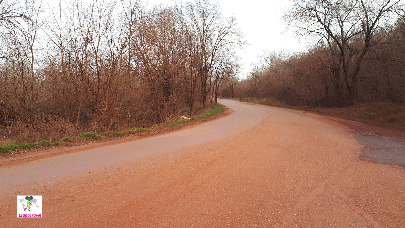
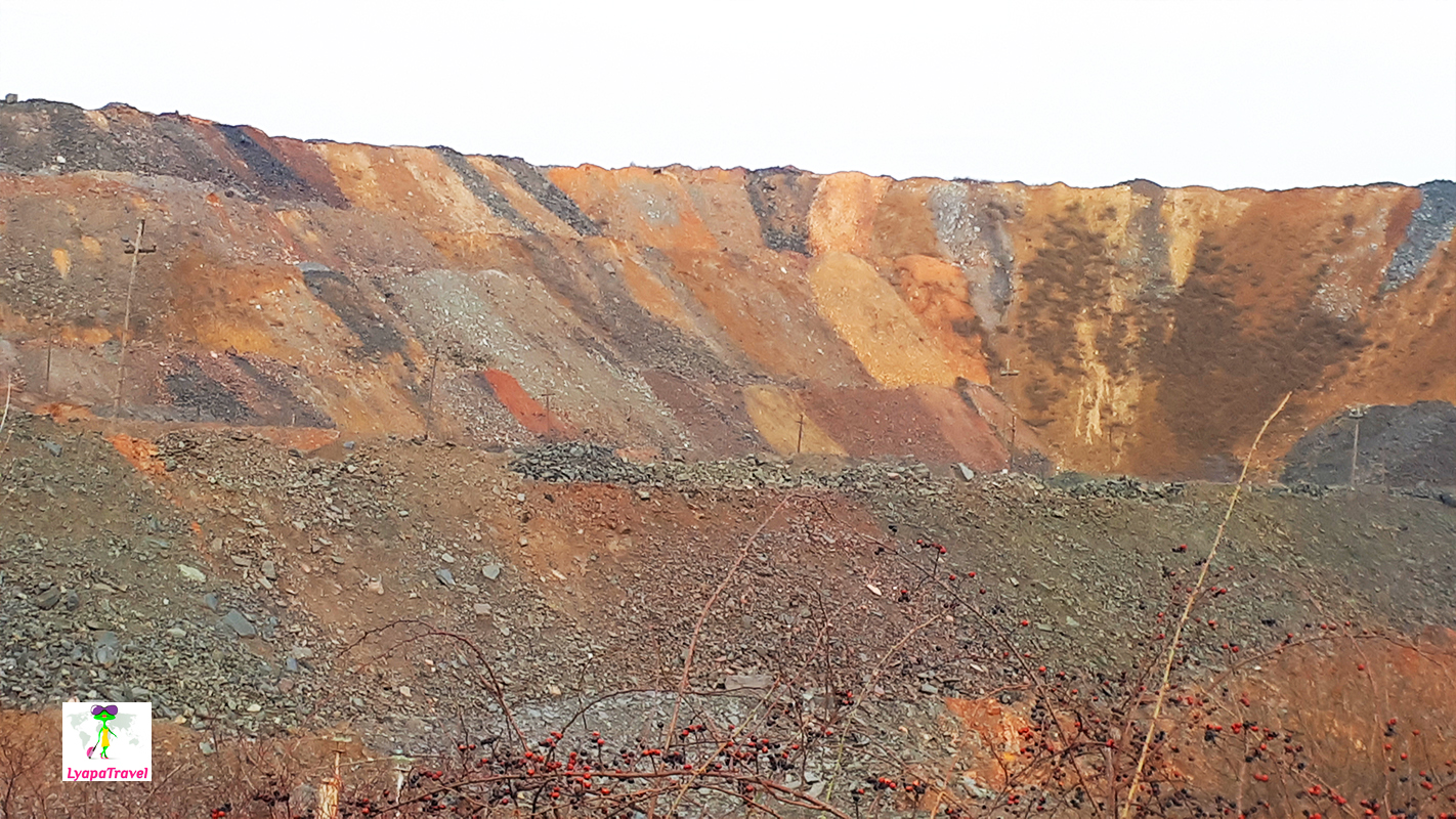
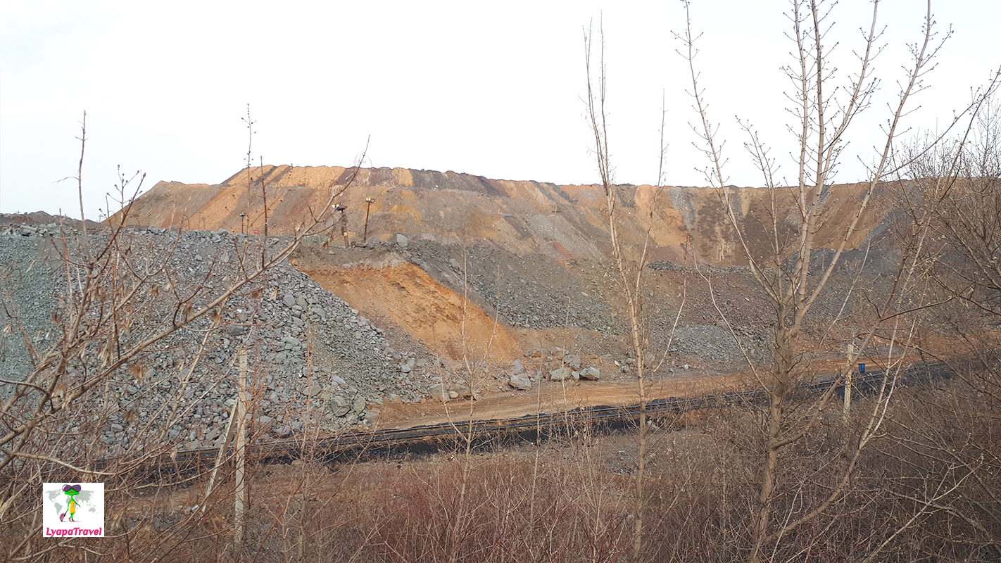
"Martian landscapes" in Krivoy Rog or just an ore mining region?
There is no need to fly to Mars or even go to India to see the dust and red roads - come to Krivoy Rog) In the granite mining regions, the streets are not so red of course. The ore mining region, on the other hand, is something ... beautiful only in pictures. In reality, one does not even want to set foot on this dust.
Red technogenic lake in Krivoy Rog - it is not one and they are not environmentally friendly...
The most famous red lake is near the mine "Artem-1" and "Gigant-Glubokaya". There are also streetcar tracks. On the Internet they write between the streetcar stops "Alexander's Field Square" and "Wise". We were at the point on the map below.
We also tried to find Lake Bowl. Drove around to about, drove in from both sides. There was no way to get closer than 1 km. We didn't go on foot. The neighborhood is so-so - a dump and mines... But we found the real "Chinese color mountains" - Krivoy Rog iron ore mountains)))!
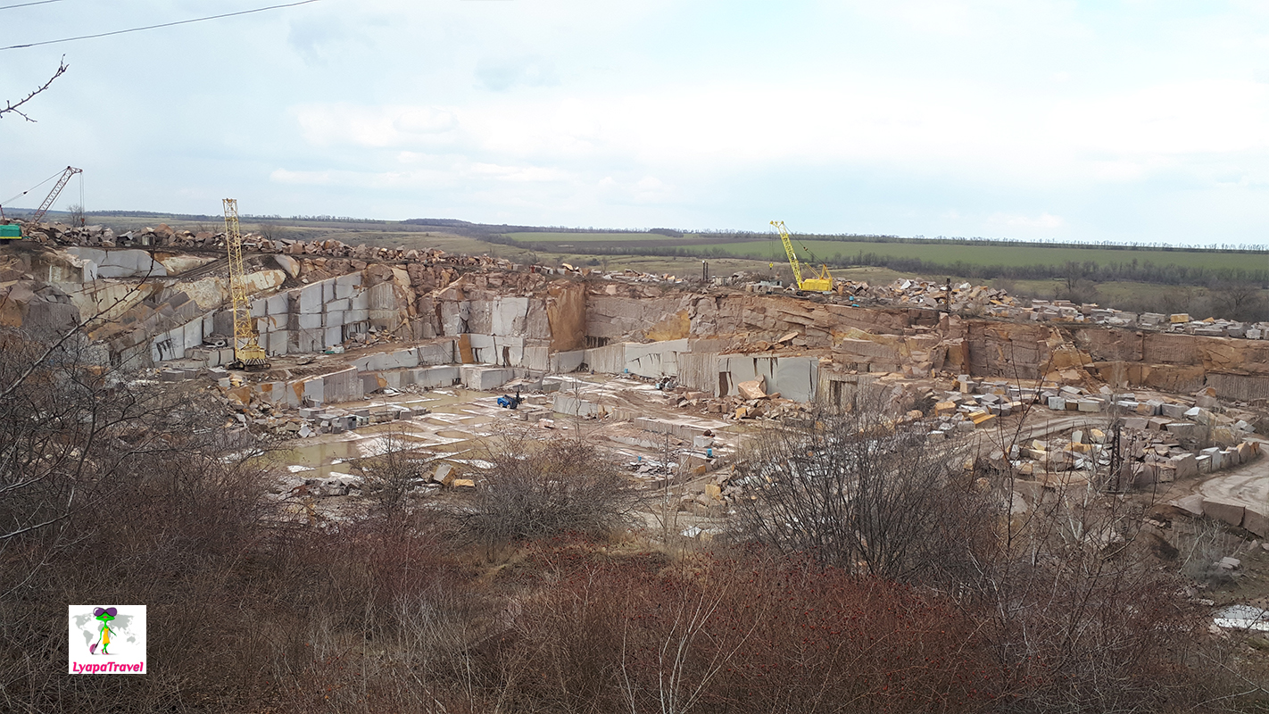
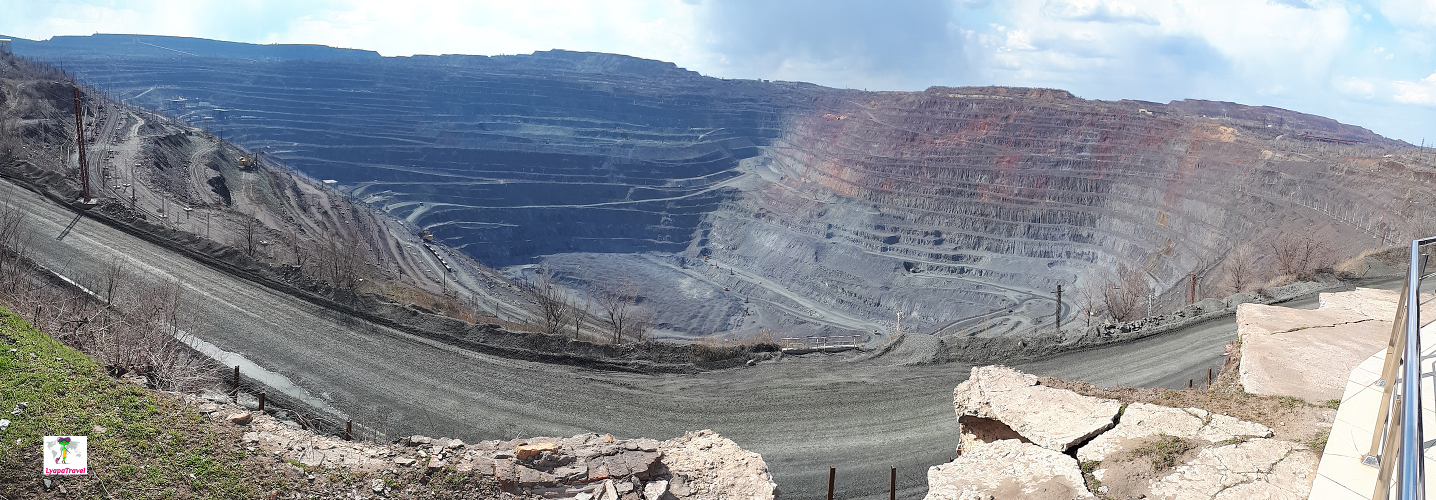
YUGOK's quarry is the largest quarry in Europe
Simply to come and visit it is not possible. To get to a closed viewing platform, the access to which is obtained in the management of existing production of the quarry, or you can sign up for a city tour through Facebook "Krivoy Rog Tourist" or you can call 0979404748. Signed us up a week in advance, setting a time and place to meet near the monument "Kozak Krivoy Rog. From there we were taken by bus to the observation deck of the quarry. All for free, since it organizes the city, in order to develop tourism in the city. Visiting time is about 1.5 hours along with the road through town.
If you have never seen other quarries, this will cause incredible excitement. The scale is amazing (approximately 2*3 km in area and 500 m deep)! Inside there are railway trains and the biggest "machines" BelAZ trucks with the wheel size of 3 m work! It is worth a visit. If you get with excursion, you will be told all details of iron ore mining and features of Yugochny open pit. In the quarry, depleted rock with ore about 20%. In the mines of Krivoy Rog there is a mining of depleted ore up to 80%. Unused "empty" rock is exported outside the city, that is how Krivoy Rog mountains - dumps are formed.
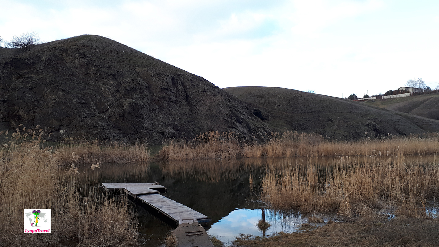
Oktyabrsky quarry (Zarechny quarry) is a flooded granite quarry and one of the best places in Krivoy Rog
It is beautiful here at any time of year. Some kind of cozy and relaxing atmosphere. You can take a walk on top of the quarry and there is a descent to the water. In summer, there is a real beach. A good place for bicycle touring and barbecues. You can approach directly to the quarry by car. However, you have to stomp down on foot.
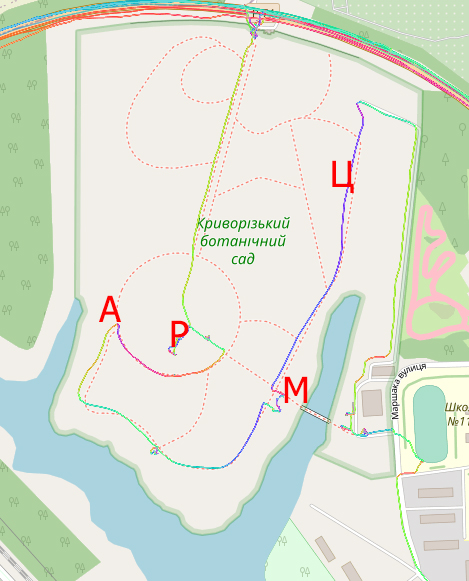
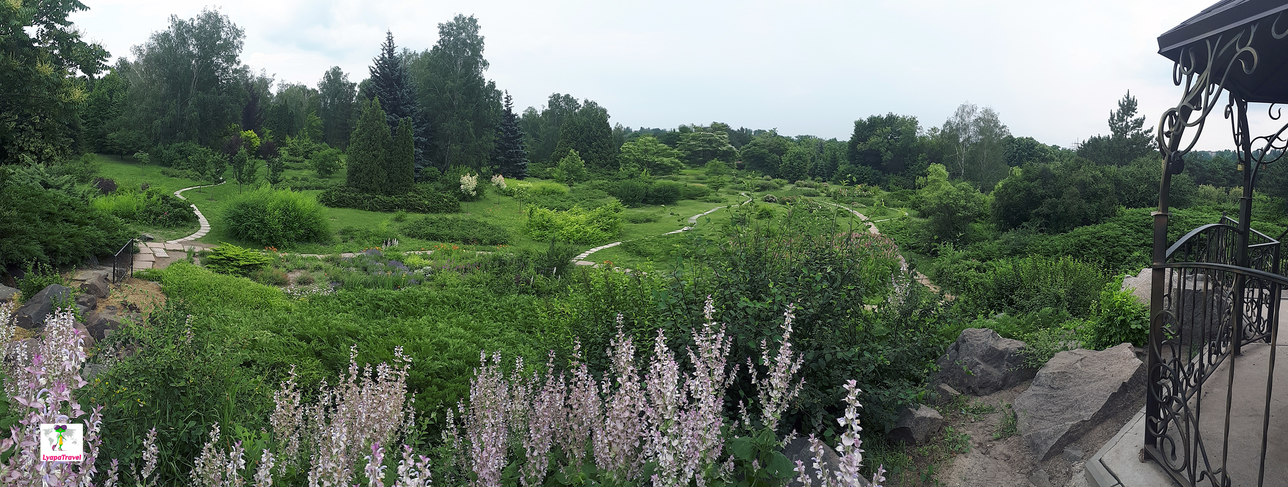
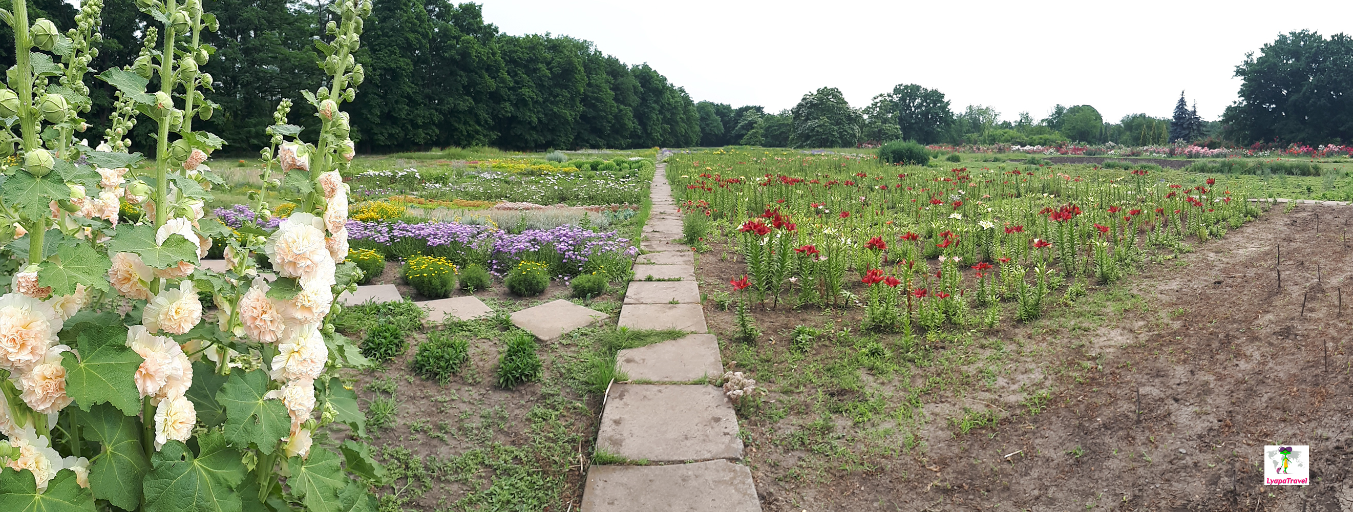
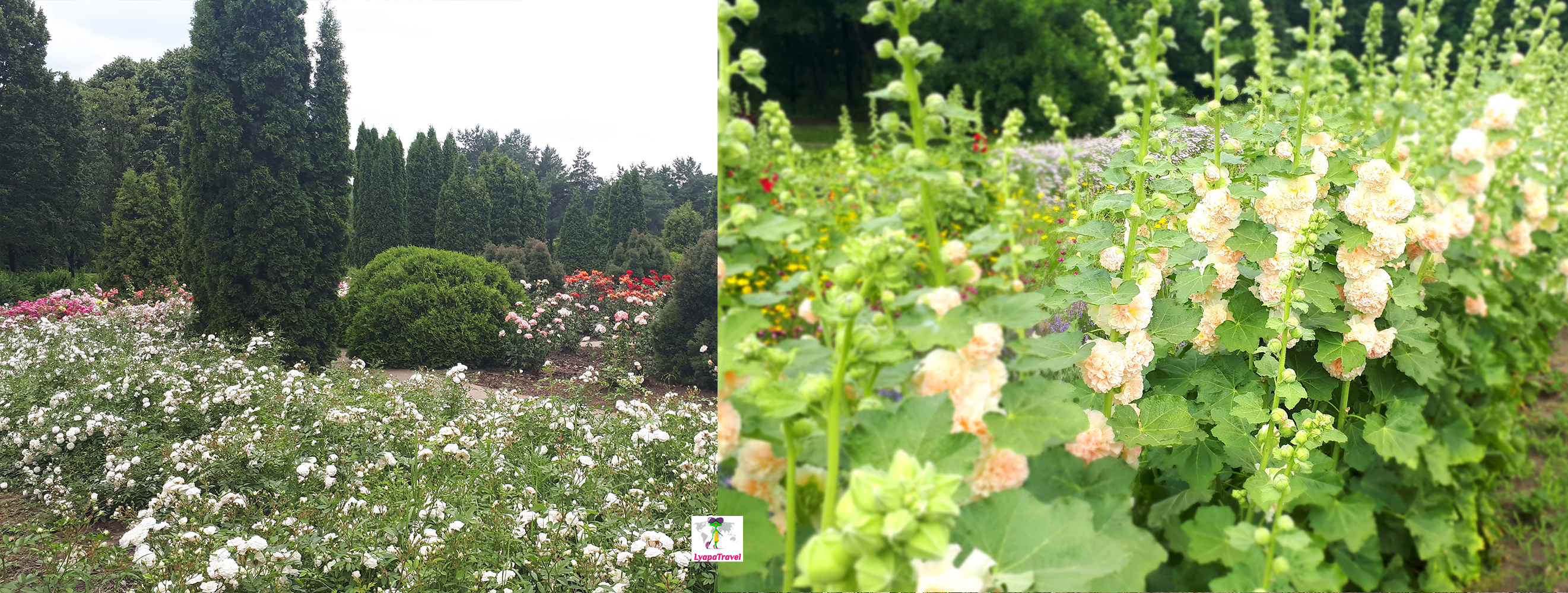
Krivoy Rog Botanical Garden of the National Academy of Sciences of Ukraine is a great place for relaxation and science)
If you consider that Krivoy Rog is an industrial city, what a surprise when you get to such a nature as a local botanical garden! Is located remotely from the city, but it is not bad) is worth to come here, especially the second half of May, early June. There is a lot of not just greenery, but flowers! There is a place to walk, there are benches, well-groomed trails...The route of the garden is circular. Entering the botanical garden, walk along the central avenue to its end and turn right. The path will curve in a radius, counterclockwise. Then go around the circle and go counterclockwise till you come to the bridge on the right. From the bridge turn left into the rose garden, which is circular. From the rose garden we go to the right, but again in a counterclockwise circle. We come to a wide alley of all kinds of flowers! At the end of it we turn left and along the path we get to the central alley of the botanical garden, almost at the exit. The above route allows you to see the heart of the botanical garden, if you want to walk, there are many paths and branches! The ticket price is low, about 40 UAH per person, but it can't be compared with the botanical garden in the same Odessa! It would seem that Odessa is a resort, an ecological area... Krivoy Rog - mines and quarries) Botanical Garden of Krivoy Rog - one of the best places in the city!
Below are maps with possible routes (arrows indicate our route):
- A - alpine garden
- Р - rose garden
- M- bridge, not working)
- Ц- an alley of seasonal flowers
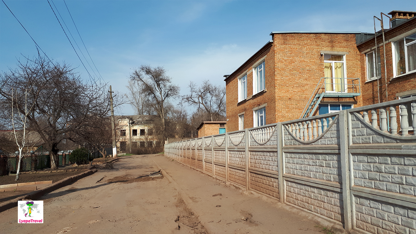
Krivoy Rog, within one day, it is convenient to see, coming from the side of the Dnieper. Here you can see the "Chinese mountains", "Lake Baikal" and "Martian landscapes" (which are very similar to the usual India). But in fact - it's just a loud name. In fact the city is drowning in mud and dust. When the wind blows, you can feel the dust on your teeth. The iron ore mining areas are indescribable - everything is red all around. There is a school and a soccer club with a field a couple of kilometers away from the iron ore mines... This is another young generation growing up in a polluted city(
In one day you can theoretically manage to see everything. But firstly you will need to prepare a clear plan of movement and lay a route. It will be necessary to make a plan and time of being at each place. But it is better of course still allocate two light days or not all visit. Places with 1 and / or 2 stars really do not require your attention! Be sure to read beforehand how to get to each place.
In one day do not combine a trip to Krivoy Rog and Tokov waterfalls. Or leave at 6-7 am in order to have time to do everything. We have the ring Dnipro - Nikopol - Tokovskoye - Krivoy Rog - Dnipro took 10 hours and 600 km. To visit the botanical garden, too, allocated from 2 hours. He is still outside the city, so it is necessary to get to him. By the way, you can take lunch with you and eat on the nature. There are benches or you can take a blanket with you.
Add new comment